Buntharik geodata
Buntharik (Changwat Ubon Ratchathani) is a seat of a second-order administrative division; located in Thailand in Asia/Bangkok (GMT+7) time zone. In our database, there are 331 cities with bigger population. Compared to other cities in Thailand, 54.1% of cities are located further ↑North; 99.9% of cities are located further ←West and 64.7% of cities have lower elevation than Buntharik. Note1


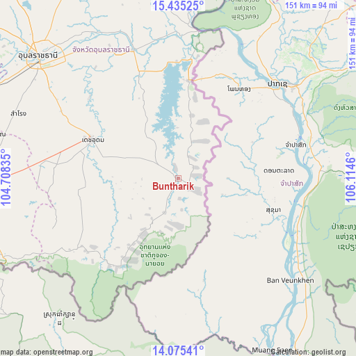
Buntharik GPS coordinates[2]
14° 45' 23.004" North, 105° 24' 41.292" East
| Map corner | latitude | longitude |
|---|---|---|
| Upper-left | 15.43525°, | 104.70835° |
| Center: | 14.75639°, | 105.41147° |
| Lower-right: | 14.07541°, | 106.1146° |
| Map W x H: | 151.2×151.2 km | = 94×94mi |
| max Lat: | 20.43353° ⇑54.1% North |
| Buntharik: | 14.75639° |
| min Lat: | ⇓45.9% South 5.77434° |
| min Long | Buntharik | max Long |
| 97.93288° | 105.41147° | 105.49506° |
| W 99.9%⇐ | ⇒0.099999999999994% E |
Elevation
Elevation of Buntharik is 159 m = 522 ft, and this is 33.5 m = 110 ft above average elevation for this country.
| Max E: |
1011 m = 3317 ft | 35.3% |
| Buntharik | 159 m 522 ft | |
| Avg. | 125.5 m = 412 ft | |
Min E: |
1 m = 3 ft | 64.7% |
See also: Thailand elevation on elevation.city.
Geographical zone
Buntharik is located in North Torrid zone (between Equator and Tropic of Cancer). Distance of this Northern Tropic circle is 965.2 km =599.7 mi to North.| Distance of | km | miles | from Buntharik |
|---|---|---|---|
| North Pole | 8366.3 | 5198.6 | to North |
| Arctic Circle | 5760.4 | 3579.3 | to North |
| Tropic Cancer | 965.2 | 599.7 | to North |
| Equator | 1640.8 | 1019.5 | to South |


Nearby cities:
15 places around Buntharik: (largest is in red/bold)
• Benchalak
79.8 km =49.6 mi,  273°
273°
• Det Udom
39.5 km =24.5 mi,  294°
294°
• Khong Chiam
63.1 km =39.2 mi,  8°
8°
• Na Chaluai
31.8 km =19.8 mi,  214°
214°
• Na Yia
50.9 km =31.6 mi,  312°
312°
• Nam Khun
55.8 km =34.7 mi,  249°
249°
• Non Kho
75.9 km =47.2 mi,  283°
283°
• Phibun Mangsahan
57.7 km =35.9 mi,  340°
340°
• Samrong
73 km =45.4 mi, 292°
• Sawang Wirawong
63.9 km =39.7 mi,  327°
327°
• Siao
79.8 km =49.6 mi, 273°
• Sirindhorn
49.5 km =30.8 mi,  357°
357°
• Tan Sum
68 km =42.3 mi, 336°
• Thung Si Udom
54.1 km =33.6 mi, 267°
• Warin Chamrap
76.4 km =47.5 mi, 309°
Sources, notices
• [Note1] Compared only with cities in Thailand existing in our database
• [Src1] Map data: © OpenStreetMap contributors (CC-BY-SA)
• [Src2] Other city data from geonames.org with taken over terms of usage.
• [Src3] Geographical zone / Annual Mean Temperature by Robert A. Rohde @ Wikipedia
