Chiang Yuen geodata
Chiang Yuen (Maha Sarakham) is a seat of a second-order administrative division; located in Thailand in Asia/Bangkok (GMT+7) time zone. In our database, there are 331 cities with bigger population. Compared to other cities in Thailand, 71% of cities are located further ↓South; 80% of cities are located further ←West and 72.8% of cities have lower elevation than Chiang Yuen. Note1


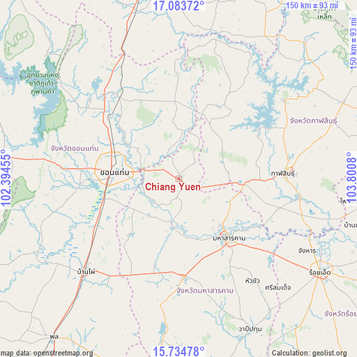
Chiang Yuen GPS coordinates[2]
16° 24' 37.512" North, 103° 5' 51.612" East
| Map corner | latitude | longitude |
|---|---|---|
| Upper-left | 17.08372°, | 102.39455° |
| Center: | 16.41042°, | 103.09767° |
| Lower-right: | 15.73478°, | 103.8008° |
| Map W x H: | 150×150 km | = 93.2×93.2mi |
| max Lat: | 20.43353° ⇑29% North |
| Chiang Yuen: | 16.41042° |
| min Lat: | ⇓71% South 5.77434° |
| min Long | Chiang Yuen | max Long |
| 97.93288° | 103.09767° | 105.49506° |
| W 80%⇐ | ⇒20% E |
Elevation
Elevation of Chiang Yuen is 177 m = 581 ft, and this is 51.5 m = 169 ft above average elevation for this country.
| Max E: |
1011 m = 3317 ft | 27.2% |
| Chiang Yuen | 177 m 581 ft | |
| Avg. | 125.5 m = 412 ft | |
Min E: |
1 m = 3 ft | 72.8% |
See also: Thailand elevation on elevation.city.
Geographical zone
Chiang Yuen is located in North Torrid zone (between Equator and Tropic of Cancer). Distance of this Northern Tropic circle is 781.3 km =485.5 mi to North.| Distance of | km | miles | from Chiang Yuen |
|---|---|---|---|
| North Pole | 8182.4 | 5084.3 | to North |
| Arctic Circle | 5576.5 | 3465.1 | to North |
| Tropic Cancer | 781.3 | 485.5 | to North |
| Equator | 1824.7 | 1133.8 | to South |


Nearby cities:
15 places around Chiang Yuen: (largest is in red/bold)
• Ban Haet
43.2 km =26.8 mi,  236°
236°
• Borabue
41 km =25.5 mi,  177°
177°
• Chuen Chom
18.1 km =11.2 mi,  27°
27°
• Huai Mek
24.8 km =15.4 mi,  36°
36°
• Kantharawichai
23.4 km =14.5 mi,  113°
113°
• Khon Kaen
28.5 km =17.7 mi,  278°
278°
• Khong Chai
41.9 km =26 mi, 113°
• Kosum Phisai
18.3 km =11.4 mi,  190°
190°
• Kranuan
33 km =20.5 mi,  356°
356°
• Kut Rang
36.4 km =22.6 mi, 194°
• Maha Sarakham
33.1 km =20.6 mi,  139°
139°
• Nam Phong
41.5 km =25.8 mi,  321°
321°
• Nong Kung Si
34.3 km =21.3 mi, 38°
• Sam Sung
14.9 km =9.3 mi,  352°
352°
• Yang Talat
28.8 km =17.9 mi,  92°
92°
Sources, notices
• [Note1] Compared only with cities in Thailand existing in our database
• [Src1] Map data: © OpenStreetMap contributors (CC-BY-SA)
• [Src2] Other city data from geonames.org with taken over terms of usage.
• [Src3] Geographical zone / Annual Mean Temperature by Robert A. Rohde @ Wikipedia
