Farkhor geodata
Farkhor (Khatlon) is a seat of a second-order administrative division; located in Tajikistan in Asia/Dushanbe (GMT+5) time zone. With population of 21,736 people, there are 16 cities with bigger population in this country. Compared to other cities in Tajikistan, 89.8% of cities are located further ↑North; 51.1% of cities are located further ←West and 68.2% of cities have higher elevation than Farkhor. Note1


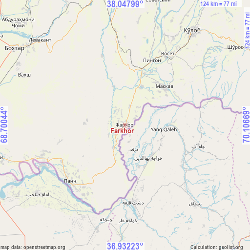
Farkhor GPS coordinates[2]
37° 29' 31.884" North, 69° 24' 12.816" East
| Map corner | latitude | longitude |
|---|---|---|
| Upper-left | 38.04799°, | 68.70044° |
| Center: | 37.49219°, | 69.40356° |
| Lower-right: | 36.93223°, | 70.10669° |
| Map W x H: | 124.1×124.1 km | = 77.1×77.1mi |
| max Lat: | 40.99827° ⇑89.8% North |
| Farkhor: | 37.49219° |
| min Lat: | ⇓10.2% South 36.72484° |
| min Long | Farkhor | max Long |
| 67.60931° | 69.40356° | 73.96674° |
| W 51.1%⇐ | ⇒48.9% E |
Elevation
Elevation of Farkhor is 444 m = 1457 ft, and this is 518.5 m = 1701 ft below average elevation for this country.
| Max E: |
3607 m = 11834 ft | 68.2% |
| Avg. | 962.5 m = 3158 ft | |
| Farkhor | 444 m = 1457 ft | |
Min E: |
324 m = 1063 ft | 31.8% |
See also: Tajikistan elevation on elevation.city.
Geographical zone
Farkhor is located in North temperate zone (between Tropic of Cancer and the Arctic Circle). Distance of this Northern Tropic circle is 1562.8 km =971.1 mi to South.| Distance of | km | miles | from Farkhor |
|---|---|---|---|
| North Pole | 5838.3 | 3627.8 | to North |
| Arctic Circle | 3232.4 | 2008.5 | to North |
| Tropic Cancer | 1562.8 | 971.1 | to South |
| Equator | 4168.7 | 2590.3 | to South |


Nearby cities:
15 places around Farkhor: (largest is in red/bold)
• Bŭstonqal’a
64 km =39.8 mi,  308°
308°
• Chubek
29.9 km =18.6 mi,  62°
62°
• Dŭstí
67.2 km =41.8 mi,  256°
256°
• Ismoili Somoní
61.2 km =38 mi,  299°
299°
• Kirov
60.2 km =37.4 mi, 307°
• Kolkhozobod
66.5 km =41.3 mi,  279°
279°
• Kŭlob
57.7 km =35.9 mi,  35°
35°
• Moskva
27.3 km =17 mi,  46°
46°
• Orzu
52 km =32.3 mi, 278°
• Panj
39.2 km =24.4 mi,  223°
223°
• Qŭrghonteppa
66.6 km =41.4 mi, 304°
• Sarband
59.8 km =37.2 mi, 314°
• Sovet
63.8 km =39.6 mi,  14°
14°
• Vakhsh
55.9 km =34.7 mi, 296°
• Vose’
40.6 km =25.2 mi,  31°
31°
Sources, notices
• [Note1] Compared only with cities in Tajikistan existing in our database
• [Src1] Map data: © OpenStreetMap contributors (CC-BY-SA)
• [Src2] Other city data from geonames.org with taken over terms of usage.
• [Src3] Geographical zone / Annual Mean Temperature by Robert A. Rohde @ Wikipedia
