Somoniyon geodata
Somoniyon (Republican Subordination) is a seat of a second-order administrative division; located in Tajikistan in Asia/Dushanbe (GMT+5) time zone. In our database, there are 65 cities with bigger population. Compared to other cities in Tajikistan, 55.7% of cities are located further ↑North; 79.5% of cities are located further →East and 52.3% of cities have higher elevation than Somoniyon. Note1


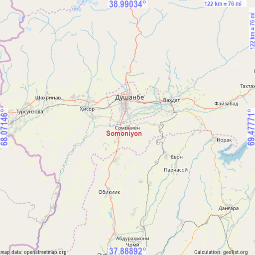
Somoniyon GPS coordinates[2]
38° 26' 30.228" North, 68° 46' 28.488" East
| Map corner | latitude | longitude |
|---|---|---|
| Upper-left | 38.99034°, | 68.07146° |
| Center: | 38.44173°, | 68.77458° |
| Lower-right: | 37.88892°, | 69.47771° |
| Map W x H: | 122.5×122.5 km | = 76.1×76.1mi |
| max Lat: | 40.99827° ⇑55.7% North |
| Somoniyon: | 38.44173° |
| min Lat: | ⇓44.3% South 36.72484° |
| min Long | Somoniyon | max Long |
| 67.60931° | 68.77458° | 73.96674° |
| W 20.5%⇐ | ⇒79.5% E |
Elevation
Elevation of Somoniyon is 742 m = 2434 ft, and this is 220.5 m = 723 ft below average elevation for this country.
| Max E: |
3607 m = 11834 ft | 52.3% |
| Avg. | 962.5 m = 3158 ft | |
| Somoniyon | 742 m = 2434 ft | |
Min E: |
324 m = 1063 ft | 47.7% |
See also: Tajikistan elevation on elevation.city.
Geographical zone
Somoniyon is located in North temperate zone (between Tropic of Cancer and the Arctic Circle). Distance of this Northern Tropic circle is 1668.4 km =1036.7 mi to South.| Distance of | km | miles | from Somoniyon |
|---|---|---|---|
| North Pole | 5732.7 | 3562.1 | to North |
| Arctic Circle | 3126.9 | 1943 | to North |
| Tropic Cancer | 1668.4 | 1036.7 | to South |
| Equator | 4274.3 | 2655.9 | to South |


Nearby cities:
15 places around Somoniyon: (largest is in red/bold)
• Abdurahmoni Jomí
55.2 km =34.3 mi,  176°
176°
• Boshkengash
3.8 km =2.4 mi,  44°
44°
• Danghara
62.6 km =38.9 mi,  127°
127°
• Dushanbe
10.5 km =6.5 mi,  2°
2°
• Fayzobod
48.9 km =30.4 mi,  76°
76°
• Hisor
21.5 km =13.4 mi,  295°
295°
• Khodzha-Maston
36 km =22.4 mi,  339°
339°
• Norak
48.1 km =29.9 mi,  96°
96°
• Obikiik
32.7 km =20.3 mi,  196°
196°
• Shahrinav
40.9 km =25.4 mi,  290°
290°
• Tagob
45.4 km =28.2 mi,  13°
13°
• Tursunzoda
47.9 km =29.8 mi,  279°
279°
• Vahdat
24.4 km =15.2 mi,  58°
58°
• Varzob
37.1 km =23.1 mi, 5°
• Yovon
27 km =16.8 mi,  121°
121°
Sources, notices
• [Note1] Compared only with cities in Tajikistan existing in our database
• [Src1] Map data: © OpenStreetMap contributors (CC-BY-SA)
• [Src2] Other city data from geonames.org with taken over terms of usage.
• [Src3] Geographical zone / Annual Mean Temperature by Robert A. Rohde @ Wikipedia
