Aileu geodata
Aileu is a seat of a first-order administrative division; located in Timor Leste in Asia/Dili (GMT+9) time zone. With population of 17,356 people, there are 4 cities with bigger population in this country. Compared to other cities in Timor Leste, 60% of cities are located further ↑North; 53.3% of cities are located further →East and 100% of cities have lower elevation than Aileu. Note1


Aileu GPS coordinates[2]
8° 43' 41.016" South, 125° 33' 59.004" East
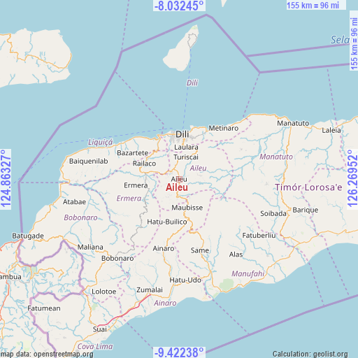
| Map corner | latitude | longitude |
|---|---|---|
| Upper-left | -8.03245°, | 124.86327° |
| Center: | -8.72806°, | 125.56639° |
| Lower-right: | -9.42238°, | 126.26952° |
| Map W x H: | 154.5×154.5 km | = 96×96mi |
| max Lat: | -8.47572° ⇑60% North |
| Aileu: | -8.72806° |
| min Lat: | ⇓40% South -9.31286° |
| min Long | Aileu | max Long |
| 124.38333° | 125.56639° | 126.99833° |
| W 46.7%⇐ | ⇒53.3% E |
Elevation
Elevation of Aileu is 926 m = 3038 ft, and this is 619.9 m = 2034 ft above average elevation for this country.
| Max E: |
926 m = 3038 ft | 0% |
| Aileu | 926 m 3038 ft | |
| Avg. | 306.1 m = 1004 ft | |
Min E: |
3 m = 10 ft | 100% |
See also: Timor Leste elevation on elevation.city.
Geographical zone
Aileu is located in South Torrid zone (between Equator and Tropic of Capricorn). Distance of Equator is 970.5 km =603 mi to North.| Distance of | km | miles | from Aileu |
|---|---|---|---|
| Equator | 970.5 | 603 | to North |
| Tropic Capricorn | 1635.4 | 1016.2 | to South |
| Antarctic Circle | 6430.7 | 3995.9 | to South |
| South Pole | 9036.6 | 5615.1 | to South |


Nearby cities:
15 places around Aileu: (largest is in red/bold)
• Ainaro
30.1 km =18.7 mi,  192°
192°
• Baukau
101.8 km =63.3 mi,  73°
73°
• Dili
18.9 km =11.7 mi,  2°
2°
• Gleno
14.3 km =8.9 mi,  271°
271°
• Likisá
29.2 km =18.1 mi,  302°
302°
• Lospalos
159.1 km =98.9 mi,  81°
81°
• Maliana
48.1 km =29.9 mi,  232°
232°
• Manatutu
54.7 km =34 mi,  63°
63°
• Maubara
41.7 km =25.9 mi,  288°
288°
• Metinaro
29.3 km =18.2 mi,  41°
41°
• Pante Makasar
140.1 km =87.1 mi,  248°
248°
• Same
32 km =19.9 mi,  163°
163°
• Suai
73.4 km =45.6 mi,  207°
207°
• Venilale
89.7 km =55.7 mi, 83°
• Viqueque
88.9 km =55.2 mi,  99°
99°
Sources, notices
• [Note1] Compared only with cities in Timor Leste existing in our database
• [Src1] Map data: © OpenStreetMap contributors (CC-BY-SA)
• [Src2] Other city data from geonames.org with taken over terms of usage.
• [Src3] Geographical zone / Annual Mean Temperature by Robert A. Rohde @ Wikipedia
