Turgutreis geodata
Turgutreis (Muğla) is a seat of a third-order administrative division; located in Turkey in Europe/Istanbul (GMT+3) time zone. With population of 16,490 people, there are 374 cities with bigger population in this country. Compared to other cities in Turkey, 87.6% of cities are located further ↑North; 95.1% of cities are located further →East and 94.3% of cities have higher elevation than Turgutreis. Note1


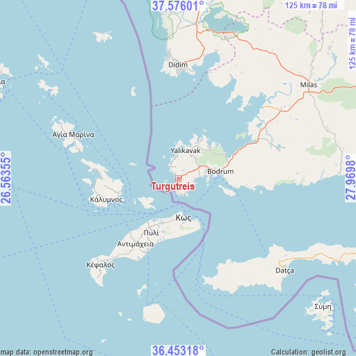
Turgutreis GPS coordinates[2]
37° 1' 0.012" North, 27° 16' 0.012" East
| Map corner | latitude | longitude |
|---|---|---|
| Upper-left | 37.57601°, | 26.56355° |
| Center: | 37.01667°, | 27.26667° |
| Lower-right: | 36.45318°, | 27.9698° |
| Map W x H: | 124.8×124.8 km | = 77.5×77.5mi |
| max Lat: | 42.02683° ⇑87.6% North |
| Turgutreis: | 37.01667° |
| min Lat: | ⇓12.4% South 35.9025° |
| min Long | Turgutreis | max Long |
| 25.90902° | 27.26667° | 44.60099° |
| W 4.9%⇐ | ⇒95.1% E |
Elevation
Elevation of Turgutreis is 18 m = 59 ft, and this is 699.4 m = 2295 ft below average elevation for this country.
| Max E: |
2682 m = 8799 ft | 94.3% |
| Avg. | 717.4 m = 2354 ft | |
| Turgutreis | 18 m = 59 ft | |
Min E: |
0 m = 0 ft | 5.7% |
See also: Turkey elevation on elevation.city.
Geographical zone
Turgutreis is located in North temperate zone (between Tropic of Cancer and the Arctic Circle). Distance of this Northern Tropic circle is 1509.9 km =938.2 mi to South.| Distance of | km | miles | from Turgutreis |
|---|---|---|---|
| North Pole | 5891.2 | 3660.6 | to North |
| Arctic Circle | 3285.3 | 2041.4 | to North |
| Tropic Cancer | 1509.9 | 938.2 | to South |
| Equator | 4115.9 | 2557.5 | to South |


Nearby cities:
15 places around Turgutreis: (largest is in red/bold)
• Akköy
52.8 km =32.8 mi,  0°
0°
• Atburgazı
68.9 km =42.8 mi,  358°
358°
• Bodrum
14.6 km =9.1 mi,  80°
80°
• Datça
48.4 km =30.1 mi,  129°
129°
• Didim
41 km =25.5 mi, 358°
• Güvercinlik
31 km =19.3 mi,  64°
64°
• Karaova
36.8 km =22.9 mi,  74°
74°
• Karatoprak
0.8 km =0.5 mi,  245°
245°
• Kiulukioi
38.6 km =24 mi,  50°
50°
• Milas
56.7 km =35.2 mi, 53°
• Ortyakent Yahşi
8.1 km =5 mi, 63°
• Sarıkemer
61.7 km =38.3 mi,  8°
8°
• Selimiye
54.8 km =34.1 mi,  38°
38°
• Yalıkavak
10.2 km =6.3 mi,  15°
15°
• Ören
62.2 km =38.6 mi,  88°
88°
Sources, notices
• [Note1] Compared only with cities in Turkey existing in our database
• [Src1] Map data: © OpenStreetMap contributors (CC-BY-SA)
• [Src2] Other city data from geonames.org with taken over terms of usage.
• [Src3] Geographical zone / Annual Mean Temperature by Robert A. Rohde @ Wikipedia
