Demre geodata
Demre (Antalya) is a seat of a second-order administrative division; located in Turkey in Europe/Istanbul (GMT+3) time zone. With population of 14,420 people, there are 401 cities with bigger population in this country. Compared to other cities in Turkey, 98.2% of cities are located further ↑North; 75.9% of cities are located further →East and 98.3% of cities have higher elevation than Demre. Note1


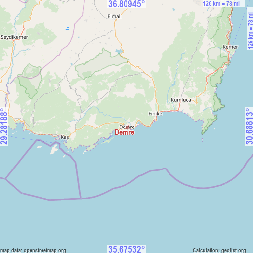
Demre GPS coordinates[2]
36° 14' 39.984" North, 29° 59' 6" East
| Map corner | latitude | longitude |
|---|---|---|
| Upper-left | 36.80945°, | 29.28188° |
| Center: | 36.24444°, | 29.985° |
| Lower-right: | 35.67532°, | 30.68813° |
| Map W x H: | 126.1×126.1 km | = 78.4×78.4mi |
| max Lat: | 42.02683° ⇑98.2% North |
| Demre: | 36.24444° |
| min Lat: | ⇓1.8% South 35.9025° |
| min Long | Demre | max Long |
| 25.90902° | 29.985° | 44.60099° |
| W 24.1%⇐ | ⇒75.9% E |
Elevation
Elevation of Demre is 9 m = 30 ft, and this is 708.4 m = 2324 ft below average elevation for this country.
| Max E: |
2682 m = 8799 ft | 98.3% |
| Avg. | 717.4 m = 2354 ft | |
| Demre | 9 m = 30 ft | |
Min E: |
0 m = 0 ft | 1.7% |
See also: Turkey elevation on elevation.city.
Geographical zone
Demre is located in North temperate zone (between Tropic of Cancer and the Arctic Circle). Distance of this Northern Tropic circle is 1424.1 km =884.9 mi to South.| Distance of | km | miles | from Demre |
|---|---|---|---|
| North Pole | 5977.1 | 3714 | to North |
| Arctic Circle | 3371.2 | 2094.8 | to North |
| Tropic Cancer | 1424.1 | 884.9 | to South |
| Equator | 4030 | 2504.1 | to South |


Nearby cities:
15 places around Demre: (largest is in red/bold)
• Akçay
45.1 km =28 mi,  331°
331°
• Altınyaka
47.7 km =29.6 mi,  42°
42°
• Beykonak
29.9 km =18.6 mi,  72°
72°
• Elmalı
55 km =34.2 mi,  353°
353°
• Eşen
67.2 km =41.8 mi,  290°
290°
• Finike
15 km =9.3 mi, 68°
• Gölova
61.9 km =38.5 mi,  4°
4°
• Göynük
68.5 km =42.6 mi,  47°
47°
• Kalkan
51.3 km =31.9 mi,  272°
272°
• Kaş
31.5 km =19.6 mi,  261°
261°
• Kemer
64.8 km =40.3 mi, 52°
• Kumluca
30.5 km =19 mi,  62°
62°
• Seki
69 km =42.9 mi, 334°
• Tekirova
56.3 km =35 mi, 59°
• Turunçova
19.4 km =12.1 mi, 44°
Sources, notices
• [Note1] Compared only with cities in Turkey existing in our database
• [Src1] Map data: © OpenStreetMap contributors (CC-BY-SA)
• [Src2] Other city data from geonames.org with taken over terms of usage.
• [Src3] Geographical zone / Annual Mean Temperature by Robert A. Rohde @ Wikipedia
