Kalkan geodata
Kalkan (Antalya) is a seat of a third-order administrative division; located in Turkey in Europe/Istanbul (GMT+3) time zone. With population of 3,000 people, there are 861 cities with bigger population in this country. Compared to other cities in Turkey, 98% of cities are located further ↑North; 80.1% of cities are located further →East and 89.7% of cities have higher elevation than Kalkan. Note1


Kalkan GPS coordinates[2]
36° 15' 54.36" North, 29° 24' 49.284" East
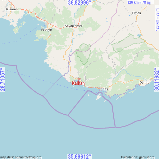
| Map corner | latitude | longitude |
|---|---|---|
| Upper-left | 36.82996°, | 28.71057° |
| Center: | 36.2651°, | 29.41369° |
| Lower-right: | 35.69612°, | 30.11682° |
| Map W x H: | 126.1×126.1 km | = 78.4×78.4mi |
| max Lat: | 42.02683° ⇑98% North |
| Kalkan: | 36.2651° |
| min Lat: | ⇓2% South 35.9025° |
| min Long | Kalkan | max Long |
| 25.90902° | 29.41369° | 44.60099° |
| W 19.9%⇐ | ⇒80.1% E |
Elevation
Elevation of Kalkan is 41 m = 135 ft, and this is 676.4 m = 2219 ft below average elevation for this country.
| Max E: |
2682 m = 8799 ft | 89.7% |
| Avg. | 717.4 m = 2354 ft | |
| Kalkan | 41 m = 135 ft | |
Min E: |
0 m = 0 ft | 10.3% |
See also: Turkey elevation on elevation.city.
Geographical zone
Kalkan is located in North temperate zone (between Tropic of Cancer and the Arctic Circle). Distance of this Northern Tropic circle is 1426.4 km =886.3 mi to South.| Distance of | km | miles | from Kalkan |
|---|---|---|---|
| North Pole | 5974.8 | 3712.6 | to North |
| Arctic Circle | 3368.9 | 2093.3 | to North |
| Tropic Cancer | 1426.4 | 886.3 | to South |
| Equator | 4032.3 | 2505.6 | to South |


Nearby cities:
15 places around Kalkan: (largest is in red/bold)
• Akçay
47.9 km =29.8 mi,  38°
38°
• Demre
51.3 km =31.9 mi,  92°
92°
• Elmalı
69.1 km =42.9 mi, 40°
• Eşen
24.2 km =15 mi,  330°
330°
• Fethiye
48.9 km =30.4 mi, 328°
• Finike
65.2 km =40.5 mi, 87°
• Göcek
68.5 km =42.6 mi,  322°
322°
• Kargı
57.2 km =35.5 mi, 328°
• Kaş
21.3 km =13.2 mi,  109°
109°
• Kemer
42.9 km =26.7 mi,  353°
353°
• Seki
63.6 km =39.5 mi,  19°
19°
• Turunçova
65.9 km =40.9 mi,  79°
79°
• Yaniklar
59 km =36.7 mi, 326°
• Yeşilüzümlü
54.5 km =33.9 mi,  342°
342°
• Ölüdeniz
41.3 km =25.7 mi, 324°
Sources, notices
• [Note1] Compared only with cities in Turkey existing in our database
• [Src1] Map data: © OpenStreetMap contributors (CC-BY-SA)
• [Src2] Other city data from geonames.org with taken over terms of usage.
• [Src3] Geographical zone / Annual Mean Temperature by Robert A. Rohde @ Wikipedia
