Tufanbeyli geodata
Tufanbeyli (Adana) is a seat of a second-order administrative division; located in Turkey in Europe/Istanbul (GMT+3) time zone. With population of 5,158 people, there are 707 cities with bigger population in this country. Compared to other cities in Turkey, 56.8% of cities are located further ↑North; 52.5% of cities are located further ←West and 88.9% of cities have lower elevation than Tufanbeyli. Note1


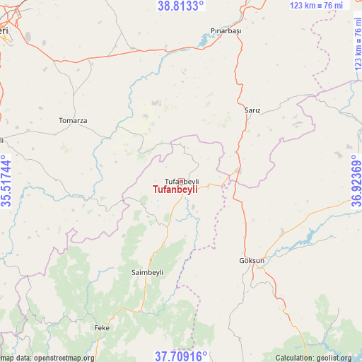
Tufanbeyli GPS coordinates[2]
38° 15' 47.988" North, 36° 13' 14.016" East
| Map corner | latitude | longitude |
|---|---|---|
| Upper-left | 38.8133°, | 35.51744° |
| Center: | 38.26333°, | 36.22056° |
| Lower-right: | 37.70916°, | 36.92369° |
| Map W x H: | 122.8×122.8 km | = 76.3×76.3mi |
| max Lat: | 42.02683° ⇑56.8% North |
| Tufanbeyli: | 38.26333° |
| min Lat: | ⇓43.2% South 35.9025° |
| min Long | Tufanbeyli | max Long |
| 25.90902° | 36.22056° | 44.60099° |
| W 52.5%⇐ | ⇒47.5% E |
Elevation
Elevation of Tufanbeyli is 1427 m = 4682 ft, and this is 709.6 m = 2328 ft above average elevation for this country.
| Max E: |
2682 m = 8799 ft | 11.1% |
| Tufanbeyli | 1427 m 4682 ft | |
| Avg. | 717.4 m = 2354 ft | |
Min E: |
0 m = 0 ft | 88.9% |
See also: Turkey elevation on elevation.city.
Geographical zone
Tufanbeyli is located in North temperate zone (between Tropic of Cancer and the Arctic Circle). Distance of this Northern Tropic circle is 1648.6 km =1024.4 mi to South.| Distance of | km | miles | from Tufanbeyli |
|---|---|---|---|
| North Pole | 5752.6 | 3574.5 | to North |
| Arctic Circle | 3146.7 | 1955.3 | to North |
| Tropic Cancer | 1648.6 | 1024.4 | to South |
| Equator | 4254.5 | 2643.6 | to South |


Nearby cities:
15 places around Tufanbeyli: (largest is in red/bold)
• Afşin
60.6 km =37.7 mi,  91°
91°
• Bakırdağı
38 km =23.6 mi,  262°
262°
• Develi
65.1 km =40.5 mi,  282°
282°
• Elbaşı
50.6 km =31.4 mi,  334°
334°
• Feke
56.7 km =35.2 mi,  208°
208°
• Göksun
36.2 km =22.5 mi,  138°
138°
• Pazarören
46 km =28.6 mi,  353°
353°
• Pınarbaşı
53.3 km =33.1 mi,  16°
16°
• Saimbeyli
32.8 km =20.4 mi,  200°
200°
• Sarız
34.1 km =21.2 mi,  45°
45°
• Tanır
62.8 km =39 mi,  73°
73°
• Toklar
24.8 km =15.4 mi,  313°
313°
• Tomarza
42 km =26.1 mi,  299°
299°
• Çardak
56.1 km =34.9 mi,  109°
109°
• Çokak
59.4 km =36.9 mi,  170°
170°
Sources, notices
• [Note1] Compared only with cities in Turkey existing in our database
• [Src1] Map data: © OpenStreetMap contributors (CC-BY-SA)
• [Src2] Other city data from geonames.org with taken over terms of usage.
• [Src3] Geographical zone / Annual Mean Temperature by Robert A. Rohde @ Wikipedia
