Sivas geodata
Sivas is a seat of a first-order administrative division; located in Turkey in Europe/Istanbul (GMT+3) time zone. With population of 264,022 people, there are 39 cities with bigger population in this country. Compared to other cities in Turkey, 64.7% of cities are located further ↓South; 56.8% of cities are located further ←West and 84.2% of cities have lower elevation than Sivas. Note1


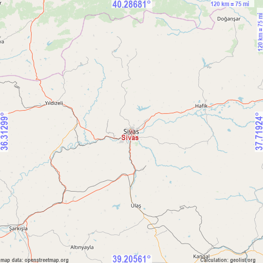
Sivas GPS coordinates[2]
39° 44' 53.988" North, 37° 0' 57.996" East
| Map corner | latitude | longitude |
|---|---|---|
| Upper-left | 40.28681°, | 36.31299° |
| Center: | 39.74833°, | 37.01611° |
| Lower-right: | 39.20561°, | 37.71924° |
| Map W x H: | 120.2×120.2 km | = 74.7×74.7mi |
| max Lat: | 42.02683° ⇑35.3% North |
| Sivas: | 39.74833° |
| min Lat: | ⇓64.7% South 35.9025° |
| min Long | Sivas | max Long |
| 25.90902° | 37.01611° | 44.60099° |
| W 56.8%⇐ | ⇒43.2% E |
Elevation
Elevation of Sivas is 1287 m = 4222 ft, and this is 569.6 m = 1869 ft above average elevation for this country.
| Max E: |
2682 m = 8799 ft | 15.8% |
| Sivas | 1287 m 4222 ft | |
| Avg. | 717.4 m = 2354 ft | |
Min E: |
0 m = 0 ft | 84.2% |
See also: Sivas elevation on elevation.city.
Geographical zone
Sivas is located in North temperate zone (between Tropic of Cancer and the Arctic Circle). Distance of this Northern Tropic circle is 1813.7 km =1127 mi to South.| Distance of | km | miles | from Sivas |
|---|---|---|---|
| North Pole | 5587.5 | 3471.9 | to North |
| Arctic Circle | 2981.6 | 1852.7 | to North |
| Tropic Cancer | 1813.7 | 1127 | to South |
| Equator | 4419.6 | 2746.2 | to South |


Nearby cities:
15 places around Sivas: (largest is in red/bold)
• Akcakışla
62.7 km =39 mi,  248°
248°
• Altınyayla
57.6 km =35.8 mi,  203°
203°
• Bedirli
38.5 km =23.9 mi,  241°
241°
• Bulucan
63.8 km =39.6 mi,  94°
94°
• Celâlli
35.4 km =22 mi,  100°
100°
• Deliktaş
48 km =29.8 mi,  160°
160°
• Direkli
31.4 km =19.5 mi,  262°
262°
• Hafik
33.8 km =21 mi,  69°
69°
• Karayün
25.8 km =16 mi,  106°
106°
• Kavak
64.5 km =40.1 mi,  141°
141°
• Kayadibi
39.6 km =24.6 mi,  221°
221°
• Ulaş
33.8 km =21 mi,  176°
176°
• Yıldızeli
38 km =23.6 mi,  290°
290°
• Çamlıbel
59.4 km =36.9 mi,  309°
309°
• Çırçır
39.8 km =24.7 mi,  328°
328°
Sources, notices
• [Note1] Compared only with cities in Turkey existing in our database
• [Src1] Map data: © OpenStreetMap contributors (CC-BY-SA)
• [Src2] Other city data from geonames.org with taken over terms of usage.
• [Src3] Geographical zone / Annual Mean Temperature by Robert A. Rohde @ Wikipedia
