Altınyayla geodata
Altınyayla (Sivas) is a seat of a second-order administrative division; located in Turkey in Europe/Istanbul (GMT+3) time zone. With population of 5,674 people, there are 674 cities with bigger population in this country. Compared to other cities in Turkey, 58.6% of cities are located further ↓South; 56% of cities are located further ←West and 89.7% of cities have lower elevation than Altınyayla. Note1


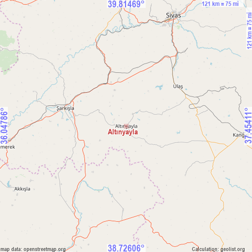
Altınyayla GPS coordinates[2]
39° 16' 20.964" North, 36° 45' 3.528" East
| Map corner | latitude | longitude |
|---|---|---|
| Upper-left | 39.81469°, | 36.04786° |
| Center: | 39.27249°, | 36.75098° |
| Lower-right: | 38.72606°, | 37.45411° |
| Map W x H: | 121×121 km | = 75.2×75.2mi |
| max Lat: | 42.02683° ⇑41.4% North |
| Altınyayla: | 39.27249° |
| min Lat: | ⇓58.6% South 35.9025° |
| min Long | Altınyayla | max Long |
| 25.90902° | 36.75098° | 44.60099° |
| W 56%⇐ | ⇒44% E |
Elevation
Elevation of Altınyayla is 1465 m = 4806 ft, and this is 747.6 m = 2453 ft above average elevation for this country.
| Max E: |
2682 m = 8799 ft | 10.3% |
| Altınyayla | 1465 m 4806 ft | |
| Avg. | 717.4 m = 2354 ft | |
Min E: |
0 m = 0 ft | 89.7% |
See also: Turkey elevation on elevation.city.
Geographical zone
Altınyayla is located in North temperate zone (between Tropic of Cancer and the Arctic Circle). Distance of this Northern Tropic circle is 1760.8 km =1094.1 mi to South.| Distance of | km | miles | from Altınyayla |
|---|---|---|---|
| North Pole | 5640.4 | 3504.8 | to North |
| Arctic Circle | 3034.5 | 1885.6 | to North |
| Tropic Cancer | 1760.8 | 1094.1 | to South |
| Equator | 4366.7 | 2713.3 | to South |


Nearby cities:
15 places around Altınyayla: (largest is in red/bold)
• Akcakışla
46.3 km =28.8 mi,  309°
309°
• Akkışla
58.1 km =36.1 mi,  238°
238°
• Bedirli
36.3 km =22.6 mi,  342°
342°
• Deliktaş
39.7 km =24.7 mi,  78°
78°
• Direkli
49.6 km =30.8 mi,  350°
350°
• Kangal
55.3 km =34.4 mi,  94°
94°
• Kayadibi
23.3 km =14.5 mi, 351°
• Kaynar
48.8 km =30.3 mi,  211°
211°
• Kuşkayası
36.8 km =22.9 mi,  129°
129°
• Ortaköy
47.4 km =29.5 mi,  290°
290°
• Sivas
57.6 km =35.8 mi,  23°
23°
• Ulaş
31.3 km =19.4 mi,  52°
52°
• Yazyurdu
54.9 km =34.1 mi,  163°
163°
• Örenşehir
31.7 km =19.7 mi,  196°
196°
• Şarkışla
30.7 km =19.1 mi, 286°
Sources, notices
• [Note1] Compared only with cities in Turkey existing in our database
• [Src1] Map data: © OpenStreetMap contributors (CC-BY-SA)
• [Src2] Other city data from geonames.org with taken over terms of usage.
• [Src3] Geographical zone / Annual Mean Temperature by Robert A. Rohde @ Wikipedia
