Sağkaya geodata
Sağkaya (Adana) is a seat of a third-order administrative division; located in Turkey in Europe/Istanbul (GMT+3) time zone. In our database, there are 1323 cities with bigger population. Compared to other cities in Turkey, 84% of cities are located further ↑North; 51.1% of cities are located further →East and 87.1% of cities have higher elevation than Sağkaya. Note1


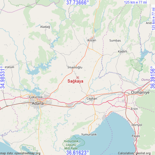
Sağkaya GPS coordinates[2]
37° 10' 42.672" North, 35° 41' 18.348" East
| Map corner | latitude | longitude |
|---|---|---|
| Upper-left | 37.73666°, | 34.98531° |
| Center: | 37.17852°, | 35.68843° |
| Lower-right: | 36.61623°, | 36.39156° |
| Map W x H: | 124.6×124.6 km | = 77.4×77.4mi |
| max Lat: | 42.02683° ⇑84% North |
| Sağkaya: | 37.17852° |
| min Lat: | ⇓16% South 35.9025° |
| min Long | Sağkaya | max Long |
| 25.90902° | 35.68843° | 44.60099° |
| W 48.9%⇐ | ⇒51.1% E |
Elevation
Elevation of Sağkaya is 59 m = 194 ft, and this is 658.4 m = 2160 ft below average elevation for this country.
| Max E: |
2682 m = 8799 ft | 87.1% |
| Avg. | 717.4 m = 2354 ft | |
| Sağkaya | 59 m = 194 ft | |
Min E: |
0 m = 0 ft | 12.9% |
See also: Turkey elevation on elevation.city.
Geographical zone
Sağkaya is located in North temperate zone (between Tropic of Cancer and the Arctic Circle). Distance of this Northern Tropic circle is 1527.9 km =949.4 mi to South.| Distance of | km | miles | from Sağkaya |
|---|---|---|---|
| North Pole | 5873.2 | 3649.4 | to North |
| Arctic Circle | 3267.3 | 2030.2 | to North |
| Tropic Cancer | 1527.9 | 949.4 | to South |
| Equator | 4133.9 | 2568.7 | to South |


Nearby cities:
15 places around Sağkaya: (largest is in red/bold)
• Adana
37.5 km =23.3 mi,  238°
238°
• Ceyhan
20.6 km =12.8 mi,  146°
146°
• Kadirli
42.1 km =26.2 mi,  58°
58°
• Kozan
32.8 km =20.4 mi,  20°
20°
• Kösreli
25.7 km =16 mi,  93°
93°
• Sarıçam
16.3 km =10.1 mi,  259°
259°
• Seyhan
40 km =24.9 mi, 237°
• Sumbas
42.4 km =26.3 mi,  44°
44°
• Tecirli
37.4 km =23.2 mi, 92°
• Tepecikören
21.1 km =13.1 mi,  344°
344°
• Toprakkale
42.4 km =26.3 mi,  106°
106°
• Yakapınar
23.6 km =14.7 mi,  194°
194°
• Yüreğir
37 km =23 mi,  232°
232°
• Çatalan
36 km =22.4 mi,  282°
282°
• İmamoğlu
10 km =6.2 mi, 343°
Sources, notices
• [Note1] Compared only with cities in Turkey existing in our database
• [Src1] Map data: © OpenStreetMap contributors (CC-BY-SA)
• [Src2] Other city data from geonames.org with taken over terms of usage.
• [Src3] Geographical zone / Annual Mean Temperature by Robert A. Rohde @ Wikipedia
