Tepecikören geodata
Tepecikören (Adana) is a seat of a third-order administrative division; located in Turkey in Europe/Istanbul (GMT+3) time zone. In our database, there are 1323 cities with bigger population. Compared to other cities in Turkey, 78.8% of cities are located further ↑North; 51.5% of cities are located further →East and 75.2% of cities have higher elevation than Tepecikören. Note1


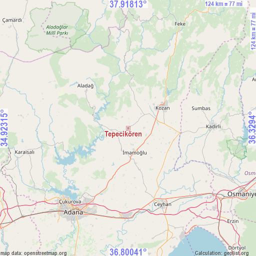
Tepecikören GPS coordinates[2]
37° 21' 40.86" North, 35° 37' 34.572" East
| Map corner | latitude | longitude |
|---|---|---|
| Upper-left | 37.91813°, | 34.92315° |
| Center: | 37.36135°, | 35.62627° |
| Lower-right: | 36.80041°, | 36.3294° |
| Map W x H: | 124.3×124.3 km | = 77.2×77.2mi |
| max Lat: | 42.02683° ⇑78.8% North |
| Tepecikören: | 37.36135° |
| min Lat: | ⇓21.2% South 35.9025° |
| min Long | Tepecikören | max Long |
| 25.90902° | 35.62627° | 44.60099° |
| W 48.5%⇐ | ⇒51.5% E |
Elevation
Elevation of Tepecikören is 172 m = 564 ft, and this is 545.4 m = 1789 ft below average elevation for this country.
| Max E: |
2682 m = 8799 ft | 75.2% |
| Avg. | 717.4 m = 2354 ft | |
| Tepecikören | 172 m = 564 ft | |
Min E: |
0 m = 0 ft | 24.8% |
See also: Turkey elevation on elevation.city.
Geographical zone
Tepecikören is located in North temperate zone (between Tropic of Cancer and the Arctic Circle). Distance of this Northern Tropic circle is 1548.3 km =962.1 mi to South.| Distance of | km | miles | from Tepecikören |
|---|---|---|---|
| North Pole | 5852.9 | 3636.8 | to North |
| Arctic Circle | 3247 | 2017.6 | to North |
| Tropic Cancer | 1548.3 | 962.1 | to South |
| Equator | 4154.2 | 2581.3 | to South |


Nearby cities:
15 places around Tepecikören: (largest is in red/bold)
• Adana
47.9 km =29.8 mi,  213°
213°
• Aladağ
29.1 km =18.1 mi,  315°
315°
• Ceyhan
41.1 km =25.5 mi,  155°
155°
• Kadirli
41.5 km =25.8 mi,  88°
88°
• Kozan
19.7 km =12.2 mi,  58°
58°
• Kösreli
38.2 km =23.7 mi,  125°
125°
• Sarıçam
25.6 km =15.9 mi,  204°
204°
• Sağkaya
21.1 km =13.1 mi, 164°
• Seyhan
50.3 km =31.3 mi, 214°
• Sumbas
36.5 km =22.7 mi,  74°
74°
• Tecirli
48.2 km =30 mi,  117°
117°
• Yakapınar
43.1 km =26.8 mi,  180°
180°
• Yüreğir
49.1 km =30.5 mi, 208°
• Çatalan
32.2 km =20 mi,  247°
247°
• İmamoğlu
11 km =6.8 mi,  165°
165°
Sources, notices
• [Note1] Compared only with cities in Turkey existing in our database
• [Src1] Map data: © OpenStreetMap contributors (CC-BY-SA)
• [Src2] Other city data from geonames.org with taken over terms of usage.
• [Src3] Geographical zone / Annual Mean Temperature by Robert A. Rohde @ Wikipedia
