Yüreğir geodata
Yüreğir (Adana) is a seat of a second-order administrative division; located in Turkey in Europe/Istanbul (GMT+3) time zone. In our database, there are 1323 cities with bigger population. Compared to other cities in Turkey, 88.6% of cities are located further ↑North; 52.7% of cities are located further →East and 93.2% of cities have higher elevation than Yüreğir. Note1


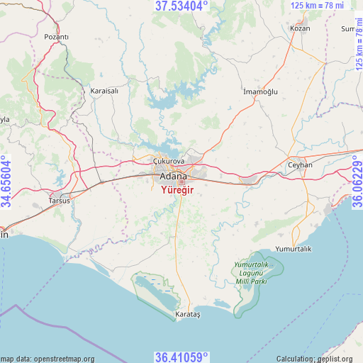
Yüreğir GPS coordinates[2]
36° 58' 27.804" North, 35° 21' 32.976" East
| Map corner | latitude | longitude |
|---|---|---|
| Upper-left | 37.53404°, | 34.65604° |
| Center: | 36.97439°, | 35.35916° |
| Lower-right: | 36.41059°, | 36.06229° |
| Map W x H: | 124.9×124.9 km | = 77.6×77.6mi |
| max Lat: | 42.02683° ⇑88.6% North |
| Yüreğir: | 36.97439° |
| min Lat: | ⇓11.4% South 35.9025° |
| min Long | Yüreğir | max Long |
| 25.90902° | 35.35916° | 44.60099° |
| W 47.3%⇐ | ⇒52.7% E |
Elevation
Elevation of Yüreğir is 24 m = 79 ft, and this is 693.4 m = 2275 ft below average elevation for this country.
| Max E: |
2682 m = 8799 ft | 93.2% |
| Avg. | 717.4 m = 2354 ft | |
| Yüreğir | 24 m = 79 ft | |
Min E: |
0 m = 0 ft | 6.8% |
See also: Turkey elevation on elevation.city.
Geographical zone
Yüreğir is located in North temperate zone (between Tropic of Cancer and the Arctic Circle). Distance of this Northern Tropic circle is 1505.2 km =935.3 mi to South.| Distance of | km | miles | from Yüreğir |
|---|---|---|---|
| North Pole | 5895.9 | 3663.5 | to North |
| Arctic Circle | 3290 | 2044.3 | to North |
| Tropic Cancer | 1505.2 | 935.3 | to South |
| Equator | 4111.2 | 2554.6 | to South |


Nearby cities:
15 places around Yüreğir: (largest is in red/bold)
• Adana
4.1 km =2.5 mi,  318°
318°
• Ceyhan
41.1 km =25.5 mi,  82°
82°
• Doğankent
14.5 km =9 mi,  185°
185°
• Karaisalı
41.2 km =25.6 mi, 319°
• Karataş
43.6 km =27.1 mi,  178°
178°
• Sarıçam
23.7 km =14.7 mi,  33°
33°
• Sağkaya
37 km =23 mi,  52°
52°
• Seyhan
4.9 km =3 mi,  287°
287°
• Tarsus
41.9 km =26 mi,  261°
261°
• Tuzla
38.9 km =24.2 mi,  218°
218°
• Yakapınar
23.2 km =14.4 mi,  90°
90°
• Yenice
27.3 km =17 mi,  270°
270°
• Yumurtalık
44.6 km =27.7 mi,  120°
120°
• Çatalan
31.1 km =19.3 mi,  348°
348°
• İmamoğlu
41.7 km =25.9 mi,  39°
39°
Sources, notices
• [Note1] Compared only with cities in Turkey existing in our database
• [Src1] Map data: © OpenStreetMap contributors (CC-BY-SA)
• [Src2] Other city data from geonames.org with taken over terms of usage.
• [Src3] Geographical zone / Annual Mean Temperature by Robert A. Rohde @ Wikipedia
