Kozan geodata
Kozan (Adana) is a seat of a second-order administrative division; located in Turkey in Europe/Istanbul (GMT+3) time zone. With population of 88,115 people, there are 101 cities with bigger population in this country. Compared to other cities in Turkey, 75.9% of cities are located further ↑North; 50.7% of cities are located further →East and 77.9% of cities have higher elevation than Kozan. Note1


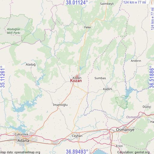
Kozan GPS coordinates[2]
37° 27' 18.612" North, 35° 48' 56.628" East
| Map corner | latitude | longitude |
|---|---|---|
| Upper-left | 38.01124°, | 35.11261° |
| Center: | 37.45517°, | 35.81573° |
| Lower-right: | 36.89493°, | 36.51886° |
| Map W x H: | 124.1×124.1 km | = 77.1×77.1mi |
| max Lat: | 42.02683° ⇑75.9% North |
| Kozan: | 37.45517° |
| min Lat: | ⇓24.1% South 35.9025° |
| min Long | Kozan | max Long |
| 25.90902° | 35.81573° | 44.60099° |
| W 49.3%⇐ | ⇒50.7% E |
Elevation
Elevation of Kozan is 140 m = 459 ft, and this is 577.4 m = 1894 ft below average elevation for this country.
| Max E: |
2682 m = 8799 ft | 77.9% |
| Avg. | 717.4 m = 2354 ft | |
| Kozan | 140 m = 459 ft | |
Min E: |
0 m = 0 ft | 22.1% |
See also: Kozan elevation on elevation.city.
Geographical zone
Kozan is located in North temperate zone (between Tropic of Cancer and the Arctic Circle). Distance of this Northern Tropic circle is 1558.7 km =968.5 mi to South.| Distance of | km | miles | from Kozan |
|---|---|---|---|
| North Pole | 5842.4 | 3630.3 | to North |
| Arctic Circle | 3236.5 | 2011.1 | to North |
| Tropic Cancer | 1558.7 | 968.5 | to South |
| Equator | 4164.6 | 2587.8 | to South |


Nearby cities:
15 places around Kozan: (largest is in red/bold)
• Aladağ
38.4 km =23.9 mi,  285°
285°
• Andırın
49.5 km =30.8 mi,  74°
74°
• Ceyhan
47.9 km =29.8 mi,  179°
179°
• Feke
40.8 km =25.4 mi,  12°
12°
• Kadirli
26.4 km =16.4 mi,  110°
110°
• Kösreli
35.6 km =22.1 mi,  156°
156°
• Mansurlu
46 km =28.6 mi,  342°
342°
• Sarıçam
43.4 km =27 mi,  218°
218°
• Sağkaya
32.8 km =20.4 mi,  200°
200°
• Sumbas
18.3 km =11.4 mi,  91°
91°
• Tecirli
41.7 km =25.9 mi,  141°
141°
• Tepecikören
19.7 km =12.2 mi,  238°
238°
• Toprakkale
52 km =32.3 mi,  145°
145°
• Çatalan
51.7 km =32.1 mi, 243°
• İmamoğlu
25.4 km =15.8 mi,  213°
213°
Sources, notices
• [Note1] Compared only with cities in Turkey existing in our database
• [Src1] Map data: © OpenStreetMap contributors (CC-BY-SA)
• [Src2] Other city data from geonames.org with taken over terms of usage.
• [Src3] Geographical zone / Annual Mean Temperature by Robert A. Rohde @ Wikipedia
