Refahiye geodata
Refahiye (Erzincan) is a seat of a second-order administrative division; located in Turkey in Europe/Istanbul (GMT+3) time zone. With population of 5,579 people, there are 679 cities with bigger population in this country. Compared to other cities in Turkey, 67.2% of cities are located further ↓South; 65.6% of cities are located further ←West and 93.4% of cities have lower elevation than Refahiye. Note1


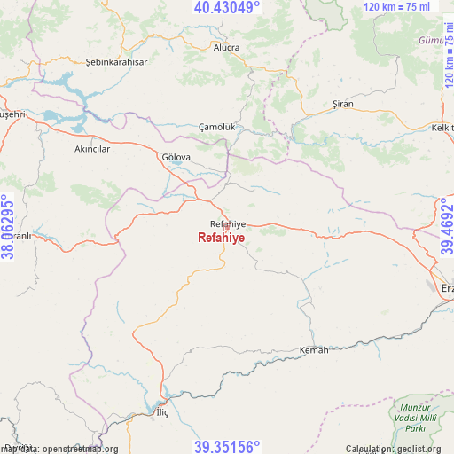
Refahiye GPS coordinates[2]
39° 53' 35.34" North, 38° 45' 57.852" East
| Map corner | latitude | longitude |
|---|---|---|
| Upper-left | 40.43049°, | 38.06295° |
| Center: | 39.89315°, | 38.76607° |
| Lower-right: | 39.35156°, | 39.4692° |
| Map W x H: | 120×120 km | = 74.6×74.6mi |
| max Lat: | 42.02683° ⇑32.8% North |
| Refahiye: | 39.89315° |
| min Lat: | ⇓67.2% South 35.9025° |
| min Long | Refahiye | max Long |
| 25.90902° | 38.76607° | 44.60099° |
| W 65.6%⇐ | ⇒34.4% E |
Elevation
Elevation of Refahiye is 1598 m = 5243 ft, and this is 880.6 m = 2889 ft above average elevation for this country.
| Max E: |
2682 m = 8799 ft | 6.6% |
| Refahiye | 1598 m 5243 ft | |
| Avg. | 717.4 m = 2354 ft | |
Min E: |
0 m = 0 ft | 93.4% |
See also: Turkey elevation on elevation.city.
Geographical zone
Refahiye is located in North temperate zone (between Tropic of Cancer and the Arctic Circle). Distance of this Northern Tropic circle is 1829.8 km =1137 mi to South.| Distance of | km | miles | from Refahiye |
|---|---|---|---|
| North Pole | 5571.4 | 3461.9 | to North |
| Arctic Circle | 2965.5 | 1842.7 | to North |
| Tropic Cancer | 1829.8 | 1137 | to South |
| Equator | 4435.7 | 2756.2 | to South |


Nearby cities:
15 places around Refahiye: (largest is in red/bold)
• Akarsu
13.6 km =8.5 mi,  286°
286°
• Akıncılar
41.1 km =25.5 mi,  298°
298°
• Alucra
47.1 km =29.3 mi,  358°
358°
• Armutlu
45.7 km =28.4 mi,  219°
219°
• Bozoğlak
30.2 km =18.8 mi,  174°
174°
• Cengerli
13 km =8.1 mi,  147°
147°
• Doğanbeyli
31.8 km =19.8 mi,  133°
133°
• Gölova
23.2 km =14.4 mi,  324°
324°
• Gümüşakar
13.6 km =8.5 mi, 215°
• Kemah
39.7 km =24.7 mi, 146°
• Kuruçay
37.6 km =23.4 mi, 221°
• Oğuz
44.2 km =27.5 mi, 166°
• Çamoluk
26.2 km =16.3 mi,  353°
353°
• Çatalçam
11.4 km =7.1 mi,  37°
37°
• Şiran
44.6 km =27.7 mi, 42°
Sources, notices
• [Note1] Compared only with cities in Turkey existing in our database
• [Src1] Map data: © OpenStreetMap contributors (CC-BY-SA)
• [Src2] Other city data from geonames.org with taken over terms of usage.
• [Src3] Geographical zone / Annual Mean Temperature by Robert A. Rohde @ Wikipedia
