Şiran geodata
Şiran (Gümüşhane) is a seat of a second-order administrative division; located in Turkey in Europe/Istanbul (GMT+3) time zone. With population of 14,692 people, there are 398 cities with bigger population in this country. Compared to other cities in Turkey, 72.3% of cities are located further ↓South; 68.7% of cities are located further ←West and 88.8% of cities have lower elevation than Şiran. Note1


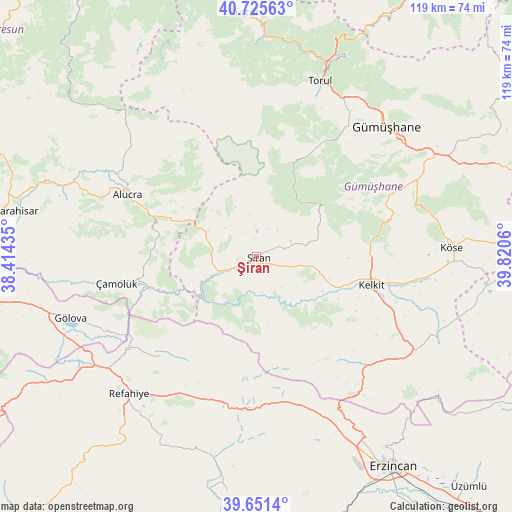
Şiran GPS coordinates[2]
40° 11' 26.304" North, 39° 7' 2.892" East
| Map corner | latitude | longitude |
|---|---|---|
| Upper-left | 40.72563°, | 38.41435° |
| Center: | 40.19064°, | 39.11747° |
| Lower-right: | 39.6514°, | 39.8206° |
| Map W x H: | 119.4×119.4 km | = 74.2×74.2mi |
| max Lat: | 42.02683° ⇑27.7% North |
| Şiran: | 40.19064° |
| min Lat: | ⇓72.3% South 35.9025° |
| min Long | Şiran | max Long |
| 25.90902° | 39.11747° | 44.60099° |
| W 68.7%⇐ | ⇒31.3% E |
Elevation
Elevation of Şiran is 1424 m = 4672 ft, and this is 706.6 m = 2318 ft above average elevation for this country.
| Max E: |
2682 m = 8799 ft | 11.2% |
| Şiran | 1424 m 4672 ft | |
| Avg. | 717.4 m = 2354 ft | |
Min E: |
0 m = 0 ft | 88.8% |
See also: Turkey elevation on elevation.city.
Geographical zone
Şiran is located in North temperate zone (between Tropic of Cancer and the Arctic Circle). Distance of this Northern Tropic circle is 1862.9 km =1157.6 mi to South.| Distance of | km | miles | from Şiran |
|---|---|---|---|
| North Pole | 5538.3 | 3441.3 | to North |
| Arctic Circle | 2932.4 | 1822.1 | to North |
| Tropic Cancer | 1862.9 | 1157.6 | to South |
| Equator | 4468.8 | 2776.8 | to South |


Nearby cities:
15 places around Şiran: (largest is in red/bold)
• Akarsu
51.8 km =32.2 mi,  235°
235°
• Alucra
34 km =21.1 mi,  294°
294°
• Cengerli
49.7 km =30.9 mi,  207°
207°
• Evren
7.8 km =4.8 mi,  38°
38°
• Gumushkhane
42.4 km =26.3 mi,  45°
45°
• Gölova
45.7 km =28.4 mi,  251°
251°
• Kale
52.7 km =32.7 mi,  65°
65°
• Kelkit
27.8 km =17.3 mi,  104°
104°
• Köse
44.9 km =27.9 mi,  87°
87°
• Refahiye
44.6 km =27.7 mi,  222°
222°
• Torul
42.4 km =26.3 mi,  19°
19°
• Yağlıdere
52.5 km =32.6 mi, 41°
• Çamoluk
33.7 km =20.9 mi,  257°
257°
• Çatalarmut
46.3 km =28.8 mi,  158°
158°
• Çatalçam
33.2 km =20.6 mi, 223°
Sources, notices
• [Note1] Compared only with cities in Turkey existing in our database
• [Src1] Map data: © OpenStreetMap contributors (CC-BY-SA)
• [Src2] Other city data from geonames.org with taken over terms of usage.
• [Src3] Geographical zone / Annual Mean Temperature by Robert A. Rohde @ Wikipedia
