Kurtalan geodata
Kurtalan (Siirt) is a seat of a second-order administrative division; located in Turkey in Europe/Istanbul (GMT+3) time zone. With population of 32,114 people, there are 236 cities with bigger population in this country. Compared to other cities in Turkey, 63.7% of cities are located further ↑North; 87.5% of cities are located further ←West and 51.1% of cities have lower elevation than Kurtalan. Note1


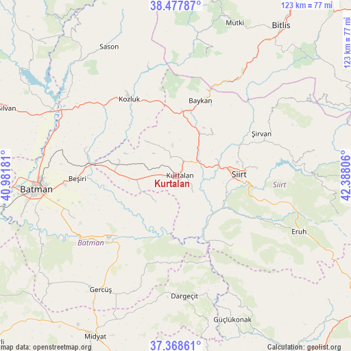
Kurtalan GPS coordinates[2]
37° 55' 31.188" North, 41° 41' 5.748" East
| Map corner | latitude | longitude |
|---|---|---|
| Upper-left | 38.47787°, | 40.98181° |
| Center: | 37.92533°, | 41.68493° |
| Lower-right: | 37.36861°, | 42.38806° |
| Map W x H: | 123.3×123.3 km | = 76.6×76.6mi |
| max Lat: | 42.02683° ⇑63.7% North |
| Kurtalan: | 37.92533° |
| min Lat: | ⇓36.3% South 35.9025° |
| min Long | Kurtalan | max Long |
| 25.90902° | 41.68493° | 44.60099° |
| W 87.5%⇐ | ⇒12.5% E |
Elevation
Elevation of Kurtalan is 715 m = 2346 ft, and this is 2.4 m = 8 ft below average elevation for this country.
| Max E: |
2682 m = 8799 ft | 48.9% |
| Avg. | 717.4 m = 2354 ft | |
| Kurtalan | 715 m = 2346 ft | |
Min E: |
0 m = 0 ft | 51.1% |
See also: Turkey elevation on elevation.city.
Geographical zone
Kurtalan is located in North temperate zone (between Tropic of Cancer and the Arctic Circle). Distance of this Northern Tropic circle is 1611 km =1001 mi to South.| Distance of | km | miles | from Kurtalan |
|---|---|---|---|
| North Pole | 5790.2 | 3597.9 | to North |
| Arctic Circle | 3184.3 | 1978.6 | to North |
| Tropic Cancer | 1611 | 1001 | to South |
| Equator | 4216.9 | 2620.3 | to South |


Nearby cities:
15 places around Kurtalan: (largest is in red/bold)
• Aktaş
11.1 km =6.9 mi,  73°
73°
• Bağlıca
8.5 km =5.3 mi,  136°
136°
• Beykent
4.7 km =2.9 mi,  177°
177°
• Beşpınar
12.2 km =7.6 mi,  216°
216°
• Civankan
17.1 km =10.6 mi,  98°
98°
• Dilektepe
20.8 km =12.9 mi,  36°
36°
• Doluharman
21.4 km =13.3 mi, 71°
• Erdurağı
9.9 km =6.2 mi,  254°
254°
• Gözpınar
20.7 km =12.9 mi,  286°
286°
• Kayabağlar
6.9 km =4.3 mi,  347°
347°
• Konakpınar
4.6 km =2.9 mi,  268°
268°
• Saipbeyli
17.3 km =10.7 mi,  297°
297°
• Siirt
22.5 km =14 mi,  88°
88°
• Taliban
24.6 km =15.3 mi,  284°
284°
• Yanarsu
17 km =10.6 mi,  316°
316°
Sources, notices
• [Note1] Compared only with cities in Turkey existing in our database
• [Src1] Map data: © OpenStreetMap contributors (CC-BY-SA)
• [Src2] Other city data from geonames.org with taken over terms of usage.
• [Src3] Geographical zone / Annual Mean Temperature by Robert A. Rohde @ Wikipedia
