Bağlıca geodata
Bağlıca (Siirt) is a seat of a third-order administrative division; located in Turkey in Europe/Istanbul (GMT+3) time zone. In our database, there are 1323 cities with bigger population. Compared to other cities in Turkey, 66.3% of cities are located further ↑North; 87.9% of cities are located further ←West and 61.9% of cities have lower elevation than Bağlıca. Note1


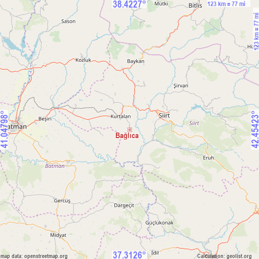
Bağlıca GPS coordinates[2]
37° 52' 11.064" North, 41° 45' 3.96" East
| Map corner | latitude | longitude |
|---|---|---|
| Upper-left | 38.4227°, | 41.04798° |
| Center: | 37.86974°, | 41.7511° |
| Lower-right: | 37.3126°, | 42.45423° |
| Map W x H: | 123.4×123.4 km | = 76.7×76.7mi |
| max Lat: | 42.02683° ⇑66.3% North |
| Bağlıca: | 37.86974° |
| min Lat: | ⇓33.7% South 35.9025° |
| min Long | Bağlıca | max Long |
| 25.90902° | 41.7511° | 44.60099° |
| W 87.9%⇐ | ⇒12.1% E |
Elevation
Elevation of Bağlıca is 913 m = 2995 ft, and this is 195.6 m = 642 ft above average elevation for this country.
| Max E: |
2682 m = 8799 ft | 38.1% |
| Bağlıca | 913 m 2995 ft | |
| Avg. | 717.4 m = 2354 ft | |
Min E: |
0 m = 0 ft | 61.9% |
See also: Turkey elevation on elevation.city.
Geographical zone
Bağlıca is located in North temperate zone (between Tropic of Cancer and the Arctic Circle). Distance of this Northern Tropic circle is 1604.8 km =997.2 mi to South.| Distance of | km | miles | from Bağlıca |
|---|---|---|---|
| North Pole | 5796.3 | 3601.7 | to North |
| Arctic Circle | 3190.5 | 1982.5 | to North |
| Tropic Cancer | 1604.8 | 997.2 | to South |
| Equator | 4210.7 | 2616.4 | to South |


Nearby cities:
15 places around Bağlıca: (largest is in red/bold)
• Aktaş
10.5 km =6.5 mi,  27°
27°
• Beykent
5.8 km =3.6 mi,  284°
284°
• Beşpınar
13.6 km =8.5 mi,  254°
254°
• Civankan
11.7 km =7.3 mi,  71°
71°
• Dilektepe
23.8 km =14.8 mi,  16°
16°
• Doluharman
19.4 km =12.1 mi,  48°
48°
• Erdurağı
15.7 km =9.8 mi, 282°
• Kayabağlar
14.9 km =9.3 mi,  330°
330°
• Konakpınar
12 km =7.5 mi,  299°
299°
• Kurtalan
8.5 km =5.3 mi,  316°
316°
• Lodi
22.7 km =14.1 mi,  140°
140°
• Saipbeyli
25.4 km =15.8 mi, 303°
• Siirt
18 km =11.2 mi, 68°
• Tillo
24.5 km =15.2 mi, 68°
• İkizbağlar
23 km =14.3 mi,  58°
58°
Sources, notices
• [Note1] Compared only with cities in Turkey existing in our database
• [Src1] Map data: © OpenStreetMap contributors (CC-BY-SA)
• [Src2] Other city data from geonames.org with taken over terms of usage.
• [Src3] Geographical zone / Annual Mean Temperature by Robert A. Rohde @ Wikipedia
