Kayabağlar geodata
Kayabağlar (Siirt) is a populated place; located in Turkey in Europe/Istanbul (GMT+3) time zone. With population of 5,601 people, there are 676 cities with bigger population in this country. Compared to other cities in Turkey, 61.8% of cities are located further ↑North; 87.2% of cities are located further ←West and 57.7% of cities have lower elevation than Kayabağlar. Note1


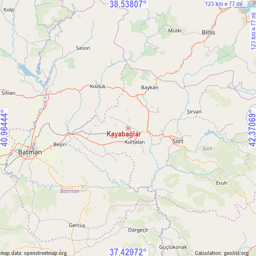
Kayabağlar GPS coordinates[2]
37° 59' 9.564" North, 41° 40' 3.216" East
| Map corner | latitude | longitude |
|---|---|---|
| Upper-left | 38.53807°, | 40.96444° |
| Center: | 37.98599°, | 41.66756° |
| Lower-right: | 37.42972°, | 42.37069° |
| Map W x H: | 123.2×123.2 km | = 76.6×76.6mi |
| max Lat: | 42.02683° ⇑61.8% North |
| Kayabağlar: | 37.98599° |
| min Lat: | ⇓38.2% South 35.9025° |
| min Long | Kayabağlar | max Long |
| 25.90902° | 41.66756° | 44.60099° |
| W 87.2%⇐ | ⇒12.8% E |
Elevation
Elevation of Kayabağlar is 839 m = 2753 ft, and this is 121.6 m = 399 ft above average elevation for this country.
| Max E: |
2682 m = 8799 ft | 42.3% |
| Kayabağlar | 839 m 2753 ft | |
| Avg. | 717.4 m = 2354 ft | |
Min E: |
0 m = 0 ft | 57.7% |
See also: Turkey elevation on elevation.city.
Geographical zone
Kayabağlar is located in North temperate zone (between Tropic of Cancer and the Arctic Circle). Distance of this Northern Tropic circle is 1617.7 km =1005.2 mi to South.| Distance of | km | miles | from Kayabağlar |
|---|---|---|---|
| North Pole | 5783.4 | 3593.6 | to North |
| Arctic Circle | 3177.5 | 1974.4 | to North |
| Tropic Cancer | 1617.7 | 1005.2 | to South |
| Equator | 4223.6 | 2624.4 | to South |


Nearby cities:
15 places around Kayabağlar: (largest is in red/bold)
• Aktaş
12.7 km =7.9 mi,  106°
106°
• Baykan
21.2 km =13.2 mi,  25°
25°
• Bağlıca
14.9 km =9.3 mi,  150°
150°
• Beykent
11.6 km =7.2 mi,  171°
171°
• Beşpınar
17.5 km =10.9 mi,  199°
199°
• Civankan
20.6 km =12.8 mi,  116°
116°
• Dilektepe
17.1 km =10.6 mi,  54°
54°
• Doluharman
21.8 km =13.5 mi,  90°
90°
• Erdurağı
12.4 km =7.7 mi,  220°
220°
• Gözpınar
18.4 km =11.4 mi,  266°
266°
• Konakpınar
7.6 km =4.7 mi, 204°
• Kurtalan
6.9 km =4.3 mi, 167°
• Saipbeyli
13.8 km =8.6 mi,  275°
275°
• Taliban
22.3 km =13.9 mi, 268°
• Yanarsu
11.6 km =7.2 mi,  299°
299°
Sources, notices
• [Note1] Compared only with cities in Turkey existing in our database
• [Src1] Map data: © OpenStreetMap contributors (CC-BY-SA)
• [Src2] Other city data from geonames.org with taken over terms of usage.
• [Src3] Geographical zone / Annual Mean Temperature by Robert A. Rohde @ Wikipedia
