Kasaba geodata
Kasaba (Bingöl) is a seat of a second-order administrative division; located in Turkey in Europe/Istanbul (GMT+3) time zone. In our database, there are 1323 cities with bigger population. Compared to other cities in Turkey, 59.1% of cities are located further ↓South; 75.5% of cities are located further ←West and 91.5% of cities have lower elevation than Kasaba. Note1


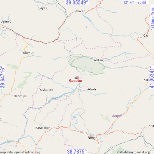
Kasaba GPS coordinates[2]
39° 18' 48.996" North, 40° 21' 1.008" East
| Map corner | latitude | longitude |
|---|---|---|
| Upper-left | 39.85549°, | 39.64716° |
| Center: | 39.31361°, | 40.35028° |
| Lower-right: | 38.7675°, | 41.05341° |
| Map W x H: | 121×121 km | = 75.2×75.2mi |
| max Lat: | 42.02683° ⇑40.9% North |
| Kasaba: | 39.31361° |
| min Lat: | ⇓59.1% South 35.9025° |
| min Long | Kasaba | max Long |
| 25.90902° | 40.35028° | 44.60099° |
| W 75.5%⇐ | ⇒24.5% E |
Elevation
Elevation of Kasaba is 1525 m = 5003 ft, and this is 807.6 m = 2650 ft above average elevation for this country.
| Max E: |
2682 m = 8799 ft | 8.5% |
| Kasaba | 1525 m 5003 ft | |
| Avg. | 717.4 m = 2354 ft | |
Min E: |
0 m = 0 ft | 91.5% |
See also: Turkey elevation on elevation.city.
Geographical zone
Kasaba is located in North temperate zone (between Tropic of Cancer and the Arctic Circle). Distance of this Northern Tropic circle is 1765.3 km =1096.9 mi to South.| Distance of | km | miles | from Kasaba |
|---|---|---|---|
| North Pole | 5635.8 | 3501.9 | to North |
| Arctic Circle | 3029.9 | 1882.7 | to North |
| Tropic Cancer | 1765.3 | 1096.9 | to South |
| Equator | 4371.3 | 2716.2 | to South |


Nearby cities:
15 places around Kasaba: (largest is in red/bold)
• Adaklı
15 km =9.3 mi,  130°
130°
• Balpayam
27.8 km =17.3 mi,  295°
295°
• Dallıbahçe
45.3 km =28.1 mi,  243°
243°
• Dağyolu
45.5 km =28.3 mi, 303°
• Dereova
42 km =26.1 mi,  260°
260°
• Ilıcalar
46.4 km =28.8 mi,  143°
143°
• Mezraa
45.9 km =28.5 mi,  280°
280°
• Nazimiye
47.3 km =29.4 mi,  251°
251°
• Pulumer
43.5 km =27 mi, 295°
• Sancak
24.8 km =15.4 mi,  172°
172°
• Turluk
43 km =26.7 mi,  289°
289°
• Yayladere
26.1 km =16.2 mi, 248°
• Yedisu
20.6 km =12.8 mi,  49°
49°
• Çan
22.3 km =13.9 mi,  214°
214°
• Üçdam
31.5 km =19.6 mi,  331°
331°
Sources, notices
• [Note1] Compared only with cities in Turkey existing in our database
• [Src1] Map data: © OpenStreetMap contributors (CC-BY-SA)
• [Src2] Other city data from geonames.org with taken over terms of usage.
• [Src3] Geographical zone / Annual Mean Temperature by Robert A. Rohde @ Wikipedia
