Ilıcalar geodata
Ilıcalar (Bingöl) is a seat of a third-order administrative division; located in Turkey in Europe/Istanbul (GMT+3) time zone. In our database, there are 1323 cities with bigger population. Compared to other cities in Turkey, 54% of cities are located further ↓South; 78% of cities are located further ←West and 78.7% of cities have lower elevation than Ilıcalar. Note1


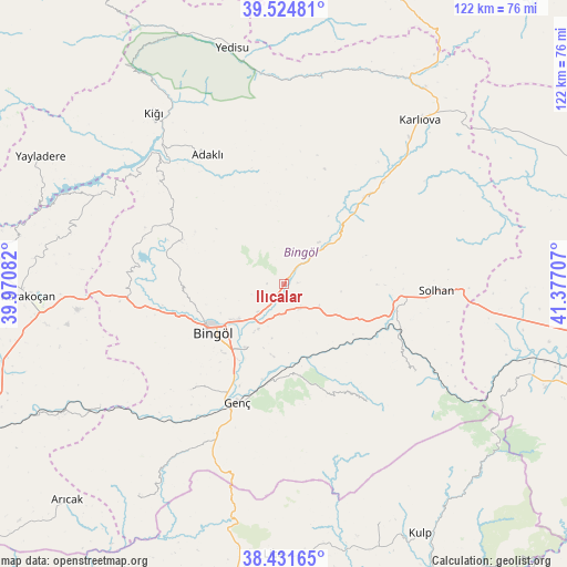
Ilıcalar GPS coordinates[2]
38° 58' 49.224" North, 40° 40' 26.184" East
| Map corner | latitude | longitude |
|---|---|---|
| Upper-left | 39.52481°, | 39.97082° |
| Center: | 38.98034°, | 40.67394° |
| Lower-right: | 38.43165°, | 41.37707° |
| Map W x H: | 121.5×121.5 km | = 75.5×75.5mi |
| max Lat: | 42.02683° ⇑46% North |
| Ilıcalar: | 38.98034° |
| min Lat: | ⇓54% South 35.9025° |
| min Long | Ilıcalar | max Long |
| 25.90902° | 40.67394° | 44.60099° |
| W 78%⇐ | ⇒22% E |
Elevation
Elevation of Ilıcalar is 1168 m = 3832 ft, and this is 450.6 m = 1478 ft above average elevation for this country.
| Max E: |
2682 m = 8799 ft | 21.3% |
| Ilıcalar | 1168 m 3832 ft | |
| Avg. | 717.4 m = 2354 ft | |
Min E: |
0 m = 0 ft | 78.7% |
See also: Turkey elevation on elevation.city.
Geographical zone
Ilıcalar is located in North temperate zone (between Tropic of Cancer and the Arctic Circle). Distance of this Northern Tropic circle is 1728.3 km =1073.9 mi to South.| Distance of | km | miles | from Ilıcalar |
|---|---|---|---|
| North Pole | 5672.9 | 3525 | to North |
| Arctic Circle | 3067 | 1905.7 | to North |
| Tropic Cancer | 1728.3 | 1073.9 | to South |
| Equator | 4334.2 | 2693.1 | to South |


Nearby cities:
15 places around Ilıcalar: (largest is in red/bold)
• Adaklı
31.9 km =19.8 mi,  328°
328°
• Bingöl
18.9 km =11.7 mi,  235°
235°
• Genç
27.9 km =17.3 mi,  201°
201°
• Gökdere
48.2 km =30 mi, 236°
• Göynük
24.7 km =15.3 mi,  44°
44°
• Karlıova
44.8 km =27.8 mi, 39°
• Kasaba
46.4 km =28.8 mi,  323°
323°
• Sancak
27.7 km =17.2 mi,  296°
296°
• Solhan
32.9 km =20.4 mi,  92°
92°
• Söğütlü
20 km =12.4 mi,  181°
181°
• Yamaç
30.5 km =19 mi,  221°
221°
• Yayla
40.9 km =25.4 mi, 198°
• Yenibaşak
33.8 km =21 mi,  125°
125°
• Yenisu
30.8 km =19.1 mi,  145°
145°
• Çan
44.7 km =27.8 mi,  294°
294°
Sources, notices
• [Note1] Compared only with cities in Turkey existing in our database
• [Src1] Map data: © OpenStreetMap contributors (CC-BY-SA)
• [Src2] Other city data from geonames.org with taken over terms of usage.
• [Src3] Geographical zone / Annual Mean Temperature by Robert A. Rohde @ Wikipedia
