Gölmarmara geodata
Gölmarmara (Manisa) is a seat of a second-order administrative division; located in Turkey in Europe/Istanbul (GMT+3) time zone. With population of 12,857 people, there are 430 cities with bigger population in this country. Compared to other cities in Turkey, 50.2% of cities are located further ↓South; 90.8% of cities are located further →East and 81.2% of cities have higher elevation than Gölmarmara. Note1


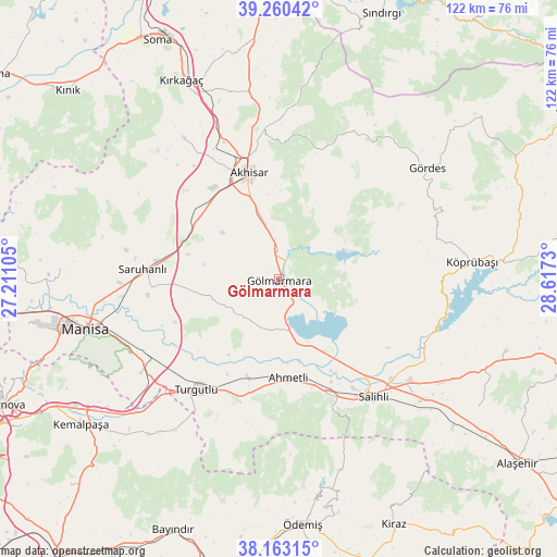
Gölmarmara GPS coordinates[2]
38° 42' 50.004" North, 27° 54' 51.012" East
| Map corner | latitude | longitude |
|---|---|---|
| Upper-left | 39.26042°, | 27.21105° |
| Center: | 38.71389°, | 27.91417° |
| Lower-right: | 38.16315°, | 28.6173° |
| Map W x H: | 122×122 km | = 75.8×75.8mi |
| max Lat: | 42.02683° ⇑49.8% North |
| Gölmarmara: | 38.71389° |
| min Lat: | ⇓50.2% South 35.9025° |
| min Long | Gölmarmara | max Long |
| 25.90902° | 27.91417° | 44.60099° |
| W 9.2%⇐ | ⇒90.8% E |
Elevation
Elevation of Gölmarmara is 105 m = 344 ft, and this is 612.4 m = 2009 ft below average elevation for this country.
| Max E: |
2682 m = 8799 ft | 81.2% |
| Avg. | 717.4 m = 2354 ft | |
| Gölmarmara | 105 m = 344 ft | |
Min E: |
0 m = 0 ft | 18.8% |
See also: Turkey elevation on elevation.city.
Geographical zone
Gölmarmara is located in North temperate zone (between Tropic of Cancer and the Arctic Circle). Distance of this Northern Tropic circle is 1698.7 km =1055.5 mi to South.| Distance of | km | miles | from Gölmarmara |
|---|---|---|---|
| North Pole | 5702.5 | 3543.4 | to North |
| Arctic Circle | 3096.6 | 1924.1 | to North |
| Tropic Cancer | 1698.7 | 1055.5 | to South |
| Equator | 4304.6 | 2674.8 | to South |


Nearby cities:
15 places around Gölmarmara: (largest is in red/bold)
• Adala
34.3 km =21.3 mi,  116°
116°
• Ahmetli
21.7 km =13.5 mi,  174°
174°
• Akhisar
23.6 km =14.7 mi,  344°
344°
• Borlu
48.2 km =30 mi,  84°
84°
• Gördes
40.6 km =25.2 mi,  53°
53°
• Halitpaşa
20.7 km =12.9 mi,  261°
261°
• Karaoğlanlı
36.5 km =22.7 mi,  235°
235°
• Köprübaşı
42.7 km =26.5 mi, 84°
• Kırkağaç
48.5 km =30.1 mi,  334°
334°
• Manisa
43.8 km =27.2 mi, 255°
• Salihli
32.8 km =20.4 mi,  141°
141°
• Saruhanlı
30.1 km =18.7 mi,  274°
274°
• Turgutlu
30.6 km =19 mi,  217°
217°
• Zeytinliova
37.1 km =23.1 mi, 326°
• Üçpınar
48 km =29.8 mi, 272°
Sources, notices
• [Note1] Compared only with cities in Turkey existing in our database
• [Src1] Map data: © OpenStreetMap contributors (CC-BY-SA)
• [Src2] Other city data from geonames.org with taken over terms of usage.
• [Src3] Geographical zone / Annual Mean Temperature by Robert A. Rohde @ Wikipedia
