Akçapınar geodata
Akçapınar (Tunceli) is a seat of a third-order administrative division; located in Turkey in Europe/Istanbul (GMT+3) time zone. In our database, there are 1323 cities with bigger population. Compared to other cities in Turkey, 53.7% of cities are located further ↓South; 66.9% of cities are located further ←West and 59.5% of cities have lower elevation than Akçapınar. Note1


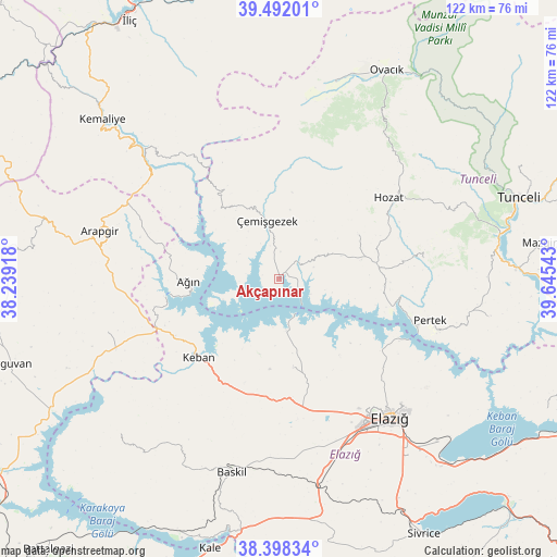
Akçapınar GPS coordinates[2]
38° 56' 50.208" North, 38° 56' 32.28" East
| Map corner | latitude | longitude |
|---|---|---|
| Upper-left | 39.49201°, | 38.23918° |
| Center: | 38.94728°, | 38.9423° |
| Lower-right: | 38.39834°, | 39.64543° |
| Map W x H: | 121.6×121.6 km | = 75.6×75.6mi |
| max Lat: | 42.02683° ⇑46.3% North |
| Akçapınar: | 38.94728° |
| min Lat: | ⇓53.7% South 35.9025° |
| min Long | Akçapınar | max Long |
| 25.90902° | 38.9423° | 44.60099° |
| W 66.9%⇐ | ⇒33.1% E |
Elevation
Elevation of Akçapınar is 874 m = 2867 ft, and this is 156.6 m = 514 ft above average elevation for this country.
| Max E: |
2682 m = 8799 ft | 40.5% |
| Akçapınar | 874 m 2867 ft | |
| Avg. | 717.4 m = 2354 ft | |
Min E: |
0 m = 0 ft | 59.5% |
See also: Turkey elevation on elevation.city.
Geographical zone
Akçapınar is located in North temperate zone (between Tropic of Cancer and the Arctic Circle). Distance of this Northern Tropic circle is 1724.6 km =1071.6 mi to South.| Distance of | km | miles | from Akçapınar |
|---|---|---|---|
| North Pole | 5676.5 | 3527.2 | to North |
| Arctic Circle | 3070.6 | 1908 | to North |
| Tropic Cancer | 1724.6 | 1071.6 | to South |
| Equator | 4330.5 | 2690.8 | to South |


Nearby cities:
15 places around Akçapınar: (largest is in red/bold)
• Ağın
20 km =12.4 mi,  267°
267°
• Başpınar
34.8 km =21.6 mi,  320°
320°
• Dere
31.2 km =19.4 mi,  82°
82°
• Dutluca
35.8 km =22.2 mi,  305°
305°
• Elazığ
38.9 km =24.2 mi,  141°
141°
• Gedikler
19.2 km =11.9 mi, 321°
• Harput
37.5 km =23.3 mi, 136°
• Hozat
28.6 km =17.8 mi,  53°
53°
• Hıdırbaba
20.3 km =12.6 mi,  171°
171°
• Karaoğlan
38.6 km =24 mi,  36°
36°
• Keban
24.8 km =15.4 mi,  226°
226°
• Pertek
34.1 km =21.2 mi,  105°
105°
• Poyraz
29.9 km =18.6 mi, 166°
• Çağlarca
19.7 km =12.2 mi,  59°
59°
• Çemişgezek
12.4 km =7.7 mi,  345°
345°
Sources, notices
• [Note1] Compared only with cities in Turkey existing in our database
• [Src1] Map data: © OpenStreetMap contributors (CC-BY-SA)
• [Src2] Other city data from geonames.org with taken over terms of usage.
• [Src3] Geographical zone / Annual Mean Temperature by Robert A. Rohde @ Wikipedia
