Yarpuz geodata
Yarpuz (Osmaniye) is a seat of a third-order administrative division; located in Turkey in Europe/Istanbul (GMT+3) time zone. In our database, there are 1323 cities with bigger population. Compared to other cities in Turkey, 87.1% of cities are located further ↑North; 54.3% of cities are located further ←West and 65.9% of cities have lower elevation than Yarpuz. Note1


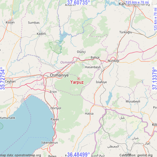
Yarpuz GPS coordinates[2]
37° 2' 53.664" North, 36° 25' 50.376" East
| Map corner | latitude | longitude |
|---|---|---|
| Upper-left | 37.60735°, | 35.72754° |
| Center: | 37.04824°, | 36.43066° |
| Lower-right: | 36.48499°, | 37.13379° |
| Map W x H: | 124.8×124.8 km | = 77.5×77.5mi |
| max Lat: | 42.02683° ⇑87.1% North |
| Yarpuz: | 37.04824° |
| min Lat: | ⇓12.9% South 35.9025° |
| min Long | Yarpuz | max Long |
| 25.90902° | 36.43066° | 44.60099° |
| W 54.3%⇐ | ⇒45.7% E |
Elevation
Elevation of Yarpuz is 974 m = 3196 ft, and this is 256.6 m = 842 ft above average elevation for this country.
| Max E: |
2682 m = 8799 ft | 34.1% |
| Yarpuz | 974 m 3196 ft | |
| Avg. | 717.4 m = 2354 ft | |
Min E: |
0 m = 0 ft | 65.9% |
See also: Turkey elevation on elevation.city.
Geographical zone
Yarpuz is located in North temperate zone (between Tropic of Cancer and the Arctic Circle). Distance of this Northern Tropic circle is 1513.5 km =940.4 mi to South.| Distance of | km | miles | from Yarpuz |
|---|---|---|---|
| North Pole | 5887.7 | 3658.4 | to North |
| Arctic Circle | 3281.8 | 2039.2 | to North |
| Tropic Cancer | 1513.5 | 940.4 | to South |
| Equator | 4119.4 | 2559.7 | to South |


Nearby cities:
15 places around Yarpuz: (largest is in red/bold)
• Bahçe
21 km =13 mi,  37°
37°
• Dörtyol
29.3 km =18.2 mi,  217°
217°
• Erzin
23.2 km =14.4 mi,  242°
242°
• Fevzipaşa
19 km =11.8 mi,  74°
74°
• Haruniye
21.7 km =13.5 mi,  5°
5°
• Hasanbeyli
13.6 km =8.5 mi,  48°
48°
• Hassa
28.7 km =17.8 mi,  164°
164°
• Kaypak
8 km =5 mi,  22°
22°
• Konaklı
29.9 km =18.6 mi,  205°
205°
• Mahmutlar
23.9 km =14.9 mi, 242°
• Nurdağı
30.2 km =18.8 mi,  63°
63°
• Osmaniye
16.5 km =10.3 mi,  280°
280°
• Tecirli
31.1 km =19.3 mi,  293°
293°
• Toprakkale
25.3 km =15.7 mi, 275°
• İslahiye
17.9 km =11.1 mi,  98°
98°
Sources, notices
• [Note1] Compared only with cities in Turkey existing in our database
• [Src1] Map data: © OpenStreetMap contributors (CC-BY-SA)
• [Src2] Other city data from geonames.org with taken over terms of usage.
• [Src3] Geographical zone / Annual Mean Temperature by Robert A. Rohde @ Wikipedia
