Hasankeyf geodata
Hasankeyf (Batman) is a seat of a second-order administrative division; located in Turkey in Europe/Istanbul (GMT+3) time zone. With population of 3,676 people, there are 807 cities with bigger population in this country. Compared to other cities in Turkey, 70.5% of cities are located further ↑North; 85.4% of cities are located further ←West and 56.4% of cities have higher elevation than Hasankeyf. Note1


Hasankeyf GPS coordinates[2]
37° 42' 22.032" North, 41° 24' 17.28" East
| Map corner | latitude | longitude |
|---|---|---|
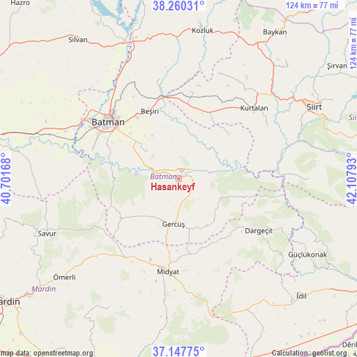
| Upper-left | 38.26031°, | 40.70168° |
| Center: | 37.70612°, | 41.4048° |
| Lower-right: | 37.14775°, | 42.10793° |
| Map W x H: | 123.7×123.7 km | = 76.9×76.9mi |
| max Lat: | 42.02683° ⇑70.5% North |
| Hasankeyf: | 37.70612° |
| min Lat: | ⇓29.5% South 35.9025° |
| min Long | Hasankeyf | max Long |
| 25.90902° | 41.4048° | 44.60099° |
| W 85.4%⇐ | ⇒14.6% E |
Elevation
Elevation of Hasankeyf is 564 m = 1850 ft, and this is 153.4 m = 503 ft below average elevation for this country.
| Max E: |
2682 m = 8799 ft | 56.4% |
| Avg. | 717.4 m = 2354 ft | |
| Hasankeyf | 564 m = 1850 ft | |
Min E: |
0 m = 0 ft | 43.6% |
See also: Turkey elevation on elevation.city.
Geographical zone
Hasankeyf is located in North temperate zone (between Tropic of Cancer and the Arctic Circle). Distance of this Northern Tropic circle is 1586.6 km =985.9 mi to South.| Distance of | km | miles | from Hasankeyf |
|---|---|---|---|
| North Pole | 5814.5 | 3613 | to North |
| Arctic Circle | 3208.6 | 1993.7 | to North |
| Tropic Cancer | 1586.6 | 985.9 | to South |
| Equator | 4192.5 | 2605.1 | to South |


Nearby cities:
15 places around Hasankeyf: (largest is in red/bold)
• Beşpınar
22.7 km =14.1 mi,  49°
49°
• Binatlı
22.8 km =14.2 mi,  313°
313°
• Derdil
10.2 km =6.3 mi,  131°
131°
• Gerdzhyush
16.1 km =10 mi,  188°
188°
• Gökçepınar
16.5 km =10.3 mi,  141°
141°
• Hisar
19.5 km =12.1 mi,  233°
233°
• Karaköy
2.6 km =1.6 mi,  166°
166°
• Kesmeköprü
1.4 km =0.9 mi,  30°
30°
• Kozlu
8.3 km =5.2 mi,  202°
202°
• Oğuz
12.4 km =7.7 mi,  347°
347°
• Yenipınar
17.7 km =11 mi,  329°
329°
• Yolağzı
20.6 km =12.8 mi, 192°
• Yontukyazı
20.8 km =12.9 mi,  341°
341°
• Çevrimova
18.9 km =11.7 mi,  322°
322°
• Çukuryurt
14.7 km =9.1 mi,  152°
152°
Sources, notices
• [Note1] Compared only with cities in Turkey existing in our database
• [Src1] Map data: © OpenStreetMap contributors (CC-BY-SA)
• [Src2] Other city data from geonames.org with taken over terms of usage.
• [Src3] Geographical zone / Annual Mean Temperature by Robert A. Rohde @ Wikipedia
