Harput geodata
Harput (Elazığ) is a seat of a third-order administrative division; located in Turkey in Europe/Istanbul (GMT+3) time zone. In our database, there are 1323 cities with bigger population. Compared to other cities in Turkey, 50.1% of cities are located further ↓South; 69.5% of cities are located further ←West and 85.1% of cities have lower elevation than Harput. Note1


Harput GPS coordinates[2]
38° 42' 13.428" North, 39° 14' 29.4" East
| Map corner | latitude | longitude |
|---|---|---|
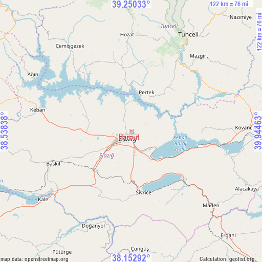
| Upper-left | 39.25033°, | 38.53838° |
| Center: | 38.70373°, | 39.2415° |
| Lower-right: | 38.15292°, | 39.94463° |
| Map W x H: | 122×122 km | = 75.8×75.8mi |
| max Lat: | 42.02683° ⇑49.9% North |
| Harput: | 38.70373° |
| min Lat: | ⇓50.1% South 35.9025° |
| min Long | Harput | max Long |
| 25.90902° | 39.2415° | 44.60099° |
| W 69.5%⇐ | ⇒30.5% E |
Elevation
Elevation of Harput is 1312 m = 4304 ft, and this is 594.6 m = 1951 ft above average elevation for this country.
| Max E: |
2682 m = 8799 ft | 14.9% |
| Harput | 1312 m 4304 ft | |
| Avg. | 717.4 m = 2354 ft | |
Min E: |
0 m = 0 ft | 85.1% |
See also: Turkey elevation on elevation.city.
Geographical zone
Harput is located in North temperate zone (between Tropic of Cancer and the Arctic Circle). Distance of this Northern Tropic circle is 1697.5 km =1054.8 mi to South.| Distance of | km | miles | from Harput |
|---|---|---|---|
| North Pole | 5703.6 | 3544.1 | to North |
| Arctic Circle | 3097.7 | 1924.8 | to North |
| Tropic Cancer | 1697.5 | 1054.8 | to South |
| Equator | 4303.5 | 2674.1 | to South |


Nearby cities:
15 places around Harput: (largest is in red/bold)
• Akçapınar
37.5 km =23.3 mi,  316°
316°
• Dere
31.5 km =19.6 mi,  9°
9°
• Elazığ
3.6 km =2.2 mi,  205°
205°
• Gözeli
34.9 km =21.7 mi, 207°
• Hankendi
21.9 km =13.6 mi,  226°
226°
• Hıdırbaba
24 km =14.9 mi,  287°
287°
• Mollakendi
16.1 km =10 mi,  150°
150°
• Pertek
19.3 km =12 mi,  21°
21°
• Poyraz
19.1 km =11.9 mi,  264°
264°
• Pınarlar
27.6 km =17.1 mi,  46°
46°
• Sivrice
29.7 km =18.5 mi,  168°
168°
• Çaybağı
32.9 km =20.4 mi,  91°
91°
• Çaybağı
34.9 km =21.7 mi,  66°
66°
• Çağlarca
38.1 km =23.7 mi,  346°
346°
• İçme
28.7 km =17.8 mi,  110°
110°
Sources, notices
• [Note1] Compared only with cities in Turkey existing in our database
• [Src1] Map data: © OpenStreetMap contributors (CC-BY-SA)
• [Src2] Other city data from geonames.org with taken over terms of usage.
• [Src3] Geographical zone / Annual Mean Temperature by Robert A. Rohde @ Wikipedia
