Gökçedağ geodata
Gökçedağ (Balıkesir) is a seat of a third-order administrative division; located in Turkey in Europe/Istanbul (GMT+3) time zone. In our database, there are 1323 cities with bigger population. Compared to other cities in Turkey, 62.2% of cities are located further ↓South; 84.4% of cities are located further →East and 55.4% of cities have higher elevation than Gökçedağ. Note1


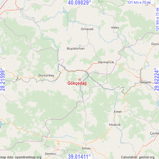
Gökçedağ GPS coordinates[2]
39° 33' 29.952" North, 28° 55' 8.796" East
| Map corner | latitude | longitude |
|---|---|---|
| Upper-left | 40.09829°, | 28.21599° |
| Center: | 39.55832°, | 28.91911° |
| Lower-right: | 39.01411°, | 29.62224° |
| Map W x H: | 120.5×120.5 km | = 74.9×74.9mi |
| max Lat: | 42.02683° ⇑37.8% North |
| Gökçedağ: | 39.55832° |
| min Lat: | ⇓62.2% South 35.9025° |
| min Long | Gökçedağ | max Long |
| 25.90902° | 28.91911° | 44.60099° |
| W 15.6%⇐ | ⇒84.4% E |
Elevation
Elevation of Gökçedağ is 579 m = 1900 ft, and this is 138.4 m = 454 ft below average elevation for this country.
| Max E: |
2682 m = 8799 ft | 55.4% |
| Avg. | 717.4 m = 2354 ft | |
| Gökçedağ | 579 m = 1900 ft | |
Min E: |
0 m = 0 ft | 44.6% |
See also: Turkey elevation on elevation.city.
Geographical zone
Gökçedağ is located in North temperate zone (between Tropic of Cancer and the Arctic Circle). Distance of this Northern Tropic circle is 1792.6 km =1113.9 mi to South.| Distance of | km | miles | from Gökçedağ |
|---|---|---|---|
| North Pole | 5608.6 | 3485 | to North |
| Arctic Circle | 3002.7 | 1865.8 | to North |
| Tropic Cancer | 1792.6 | 1113.9 | to South |
| Equator | 4398.5 | 2733.1 | to South |


Nearby cities:
15 places around Gökçedağ: (largest is in red/bold)
• Büyükorhan
23.8 km =14.8 mi,  353°
353°
• Dağardı
15.6 km =9.7 mi,  155°
155°
• Devecikonağı
50.1 km =31.1 mi,  322°
322°
• Dursunbey
25.3 km =15.7 mi,  276°
276°
• Emet
37.7 km =23.4 mi,  129°
129°
• Harmancık
24.1 km =15 mi,  57°
57°
• Hisarcık
43.5 km =27 mi,  141°
141°
• Karıncalı
46.2 km =28.7 mi, 353°
• Kavacık
38.6 km =24 mi,  289°
289°
• Keles
47.6 km =29.6 mi,  33°
33°
• Kireç
47.5 km =29.5 mi,  269°
269°
• Orhaneli
38.8 km =24.1 mi,  9°
9°
• Tavşanlı
49.7 km =30.9 mi,  92°
92°
• Yağcılar
48.8 km =30.3 mi,  251°
251°
• Yenice
22.5 km =14 mi,  357°
357°
Sources, notices
• [Note1] Compared only with cities in Turkey existing in our database
• [Src1] Map data: © OpenStreetMap contributors (CC-BY-SA)
• [Src2] Other city data from geonames.org with taken over terms of usage.
• [Src3] Geographical zone / Annual Mean Temperature by Robert A. Rohde @ Wikipedia
