Tavşanlı geodata
Tavşanlı (Kütahya) is a seat of a second-order administrative division; located in Turkey in Europe/Istanbul (GMT+3) time zone. With population of 52,182 people, there are 166 cities with bigger population in this country. Compared to other cities in Turkey, 61.9% of cities are located further ↓South; 79.6% of cities are located further →East and 58.7% of cities have lower elevation than Tavşanlı. Note1


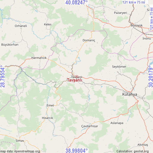
Tavşanlı GPS coordinates[2]
39° 32' 32.532" North, 29° 29' 55.176" East
| Map corner | latitude | longitude |
|---|---|---|
| Upper-left | 40.08247°, | 28.79554° |
| Center: | 39.54237°, | 29.49866° |
| Lower-right: | 38.99804°, | 30.20179° |
| Map W x H: | 120.6×120.6 km | = 74.9×74.9mi |
| max Lat: | 42.02683° ⇑38.1% North |
| Tavşanlı: | 39.54237° |
| min Lat: | ⇓61.9% South 35.9025° |
| min Long | Tavşanlı | max Long |
| 25.90902° | 29.49866° | 44.60099° |
| W 20.4%⇐ | ⇒79.6% E |
Elevation
Elevation of Tavşanlı is 859 m = 2818 ft, and this is 141.6 m = 465 ft above average elevation for this country.
| Max E: |
2682 m = 8799 ft | 41.3% |
| Tavşanlı | 859 m 2818 ft | |
| Avg. | 717.4 m = 2354 ft | |
Min E: |
0 m = 0 ft | 58.7% |
See also: Tavşanlı elevation on elevation.city.
Geographical zone
Tavşanlı is located in North temperate zone (between Tropic of Cancer and the Arctic Circle). Distance of this Northern Tropic circle is 1790.8 km =1112.8 mi to South.| Distance of | km | miles | from Tavşanlı |
|---|---|---|---|
| North Pole | 5610.4 | 3486.1 | to North |
| Arctic Circle | 3004.5 | 1866.9 | to North |
| Tropic Cancer | 1790.8 | 1112.8 | to South |
| Equator | 4396.7 | 2732 | to South |


Nearby cities:
15 places around Tavşanlı: (largest is in red/bold)
• Aslanapa
48.3 km =30 mi,  138°
138°
• Dağardı
44.9 km =27.9 mi,  253°
253°
• Dodurga
45.8 km =28.5 mi,  51°
51°
• Domaniç
30.4 km =18.9 mi,  18°
18°
• Emet
30.3 km =18.8 mi,  222°
222°
• Gökçedağ
49.7 km =30.9 mi,  272°
272°
• Harmancık
33 km =20.5 mi,  296°
296°
• Hisarcık
39.8 km =24.7 mi, 215°
• Keles
47.3 km =29.4 mi,  330°
330°
• Köprüören
22.9 km =14.2 mi,  99°
99°
• Kütahya
43.6 km =27.1 mi,  107°
107°
• Tahtaköprü
47.1 km =29.3 mi, 15°
• Yenice
56.2 km =34.9 mi, 295°
• Çavdarhisar
40.2 km =25 mi,  165°
165°
• Örencik
31.4 km =19.5 mi, 172°
Sources, notices
• [Note1] Compared only with cities in Turkey existing in our database
• [Src1] Map data: © OpenStreetMap contributors (CC-BY-SA)
• [Src2] Other city data from geonames.org with taken over terms of usage.
• [Src3] Geographical zone / Annual Mean Temperature by Robert A. Rohde @ Wikipedia
