Domaniç geodata
Domaniç (Kütahya) is a seat of a second-order administrative division; located in Turkey in Europe/Istanbul (GMT+3) time zone. With population of 5,015 people, there are 724 cities with bigger population in this country. Compared to other cities in Turkey, 65.8% of cities are located further ↓South; 78.7% of cities are located further →East and 60.3% of cities have lower elevation than Domaniç. Note1


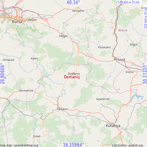
Domaniç GPS coordinates[2]
39° 48' 6.984" North, 29° 36' 33.048" East
| Map corner | latitude | longitude |
|---|---|---|
| Upper-left | 40.34°, | 28.90606° |
| Center: | 39.80194°, | 29.60918° |
| Lower-right: | 39.25964°, | 30.31231° |
| Map W x H: | 120.1×120.1 km | = 74.6×74.6mi |
| max Lat: | 42.02683° ⇑34.2% North |
| Domaniç: | 39.80194° |
| min Lat: | ⇓65.8% South 35.9025° |
| min Long | Domaniç | max Long |
| 25.90902° | 29.60918° | 44.60099° |
| W 21.3%⇐ | ⇒78.7% E |
Elevation
Elevation of Domaniç is 888 m = 2913 ft, and this is 170.6 m = 560 ft above average elevation for this country.
| Max E: |
2682 m = 8799 ft | 39.7% |
| Domaniç | 888 m 2913 ft | |
| Avg. | 717.4 m = 2354 ft | |
Min E: |
0 m = 0 ft | 60.3% |
See also: Turkey elevation on elevation.city.
Geographical zone
Domaniç is located in North temperate zone (between Tropic of Cancer and the Arctic Circle). Distance of this Northern Tropic circle is 1819.6 km =1130.6 mi to South.| Distance of | km | miles | from Domaniç |
|---|---|---|---|
| North Pole | 5581.5 | 3468.2 | to North |
| Arctic Circle | 2975.6 | 1849 | to North |
| Tropic Cancer | 1819.6 | 1130.6 | to South |
| Equator | 4425.6 | 2749.9 | to South |


Nearby cities:
15 places around Domaniç: (largest is in red/bold)
• Alanyurt
35 km =21.7 mi,  347°
347°
• Bozüyük
38.3 km =23.8 mi,  72°
72°
• Cerrah
33 km =20.5 mi,  335°
335°
• Dodurga
26.3 km =16.3 mi,  90°
90°
• Hamzabey
37.8 km =23.5 mi, 349°
• Harmancık
41.3 km =25.7 mi,  250°
250°
• Keles
34.7 km =21.6 mi,  290°
290°
• Kozluören
42.2 km =26.2 mi,  328°
328°
• Kurşunlu
26.5 km =16.5 mi,  9°
9°
• Köprüören
35.2 km =21.9 mi,  158°
158°
• Pazaryeri
33 km =20.5 mi,  49°
49°
• Tahtaköprü
16.8 km =10.4 mi, 11°
• Tavşanlı
30.4 km =18.9 mi,  198°
198°
• Yenice
35.6 km =22.1 mi, 333°
• İnegol
31.8 km =19.8 mi, 345°
Sources, notices
• [Note1] Compared only with cities in Turkey existing in our database
• [Src1] Map data: © OpenStreetMap contributors (CC-BY-SA)
• [Src2] Other city data from geonames.org with taken over terms of usage.
• [Src3] Geographical zone / Annual Mean Temperature by Robert A. Rohde @ Wikipedia
