Bozkurt geodata
Bozkurt (Denizli) is a seat of a second-order administrative division; located in Turkey in Europe/Istanbul (GMT+3) time zone. With population of 4,109 people, there are 771 cities with bigger population in this country. Compared to other cities in Turkey, 67.9% of cities are located further ↑North; 78.7% of cities are located further →East and 58.8% of cities have lower elevation than Bozkurt. Note1


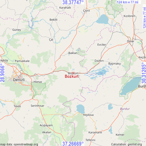
Bozkurt GPS coordinates[2]
37° 49' 27.012" North, 29° 36' 34.992" East
| Map corner | latitude | longitude |
|---|---|---|
| Upper-left | 38.37747°, | 28.9066° |
| Center: | 37.82417°, | 29.60972° |
| Lower-right: | 37.26669°, | 30.31285° |
| Map W x H: | 123.5×123.5 km | = 76.7×76.7mi |
| max Lat: | 42.02683° ⇑67.9% North |
| Bozkurt: | 37.82417° |
| min Lat: | ⇓32.1% South 35.9025° |
| min Long | Bozkurt | max Long |
| 25.90902° | 29.60972° | 44.60099° |
| W 21.3%⇐ | ⇒78.7% E |
Elevation
Elevation of Bozkurt is 861 m = 2825 ft, and this is 143.6 m = 471 ft above average elevation for this country.
| Max E: |
2682 m = 8799 ft | 41.2% |
| Bozkurt | 861 m 2825 ft | |
| Avg. | 717.4 m = 2354 ft | |
Min E: |
0 m = 0 ft | 58.8% |
See also: Turkey elevation on elevation.city.
Geographical zone
Bozkurt is located in North temperate zone (between Tropic of Cancer and the Arctic Circle). Distance of this Northern Tropic circle is 1599.7 km =994 mi to South.| Distance of | km | miles | from Bozkurt |
|---|---|---|---|
| North Pole | 5801.4 | 3604.8 | to North |
| Arctic Circle | 3195.5 | 1985.6 | to North |
| Tropic Cancer | 1599.7 | 994 | to South |
| Equator | 4205.7 | 2613.3 | to South |


Nearby cities:
15 places around Bozkurt: (largest is in red/bold)
• Akkent
41.8 km =26 mi,  331°
331°
• Akköy
48.9 km =30.4 mi,  287°
287°
• Baklan
17 km =10.6 mi,  359°
359°
• Başmakçı
36.2 km =22.5 mi,  77°
77°
• Bekilli
48.2 km =30 mi,  339°
339°
• Dazkırı
24.4 km =15.2 mi,  64°
64°
• Denizli
46.2 km =28.7 mi,  263°
263°
• Evciler
34.3 km =21.3 mi,  45°
45°
• Honaz
30.8 km =19.1 mi, 256°
• Pamukkale
44.4 km =27.6 mi,  283°
283°
• Pamukkale
44.8 km =27.8 mi,  265°
265°
• Serinhisar
40.5 km =25.2 mi,  228°
228°
• Yeşilova
37.4 km =23.2 mi,  160°
160°
• Çal
34.3 km =21.3 mi, 327°
• Çardak
5.2 km =3.2 mi,  86°
86°
Sources, notices
• [Note1] Compared only with cities in Turkey existing in our database
• [Src1] Map data: © OpenStreetMap contributors (CC-BY-SA)
• [Src2] Other city data from geonames.org with taken over terms of usage.
• [Src3] Geographical zone / Annual Mean Temperature by Robert A. Rohde @ Wikipedia
