Honaz geodata
Honaz (Denizli) is a seat of a second-order administrative division; located in Turkey in Europe/Istanbul (GMT+3) time zone. With population of 7,974 people, there are 577 cities with bigger population in this country. Compared to other cities in Turkey, 69.3% of cities are located further ↑North; 81.3% of cities are located further →East and 56.7% of cities have higher elevation than Honaz. Note1


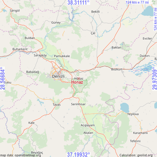
Honaz GPS coordinates[2]
37° 45' 26.28" North, 29° 16' 11.856" East
| Map corner | latitude | longitude |
|---|---|---|
| Upper-left | 38.31111°, | 28.56684° |
| Center: | 37.7573°, | 29.26996° |
| Lower-right: | 37.19932°, | 29.97309° |
| Map W x H: | 123.6×123.6 km | = 76.8×76.8mi |
| max Lat: | 42.02683° ⇑69.3% North |
| Honaz: | 37.7573° |
| min Lat: | ⇓30.7% South 35.9025° |
| min Long | Honaz | max Long |
| 25.90902° | 29.26996° | 44.60099° |
| W 18.7%⇐ | ⇒81.3% E |
Elevation
Elevation of Honaz is 559 m = 1834 ft, and this is 158.4 m = 520 ft below average elevation for this country.
| Max E: |
2682 m = 8799 ft | 56.7% |
| Avg. | 717.4 m = 2354 ft | |
| Honaz | 559 m = 1834 ft | |
Min E: |
0 m = 0 ft | 43.3% |
See also: Turkey elevation on elevation.city.
Geographical zone
Honaz is located in North temperate zone (between Tropic of Cancer and the Arctic Circle). Distance of this Northern Tropic circle is 1592.3 km =989.4 mi to South.| Distance of | km | miles | from Honaz |
|---|---|---|---|
| North Pole | 5808.8 | 3609.4 | to North |
| Arctic Circle | 3203 | 1990.3 | to North |
| Tropic Cancer | 1592.3 | 989.4 | to South |
| Equator | 4198.2 | 2608.6 | to South |


Nearby cities:
15 places around Honaz: (largest is in red/bold)
• Acıpayam
37.7 km =23.4 mi,  169°
169°
• Akköy
27.9 km =17.3 mi,  322°
322°
• Babadağ
36.7 km =22.8 mi,  278°
278°
• Baklan
38.5 km =23.9 mi,  50°
50°
• Bozkurt
30.8 km =19.1 mi,  76°
76°
• Denizli
16.1 km =10 mi, 276°
• Kızılcabölük
27.4 km =17 mi,  233°
233°
• Merkezefendi
20.7 km =12.9 mi, 284°
• Pamukkale
15.3 km =9.5 mi, 284°
• Pamukkale
22.2 km =13.8 mi, 322°
• Sarayköy
35.5 km =22.1 mi,  301°
301°
• Serinhisar
19.6 km =12.2 mi,  180°
180°
• Tavas
26.9 km =16.7 mi,  220°
220°
• Çal
38 km =23.6 mi,  17°
17°
• Çardak
35.8 km =22.2 mi, 77°
Sources, notices
• [Note1] Compared only with cities in Turkey existing in our database
• [Src1] Map data: © OpenStreetMap contributors (CC-BY-SA)
• [Src2] Other city data from geonames.org with taken over terms of usage.
• [Src3] Geographical zone / Annual Mean Temperature by Robert A. Rohde @ Wikipedia
