Uzunkavak geodata
Uzunkavak (Hatay) is a populated place; located in Turkey in Europe/Istanbul (GMT+3) time zone. With population of 1,013 people, there are 1088 cities with bigger population in this country. Compared to other cities in Turkey, 97.5% of cities are located further ↑North; 54.2% of cities are located further ←West and 83.3% of cities have higher elevation than Uzunkavak. Note1


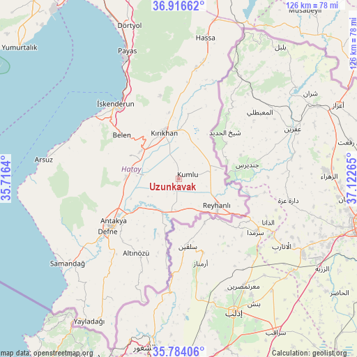
Uzunkavak GPS coordinates[2]
36° 21' 8.64" North, 36° 25' 10.272" East
| Map corner | latitude | longitude |
|---|---|---|
| Upper-left | 36.91662°, | 35.7164° |
| Center: | 36.3524°, | 36.41952° |
| Lower-right: | 35.78406°, | 37.12265° |
| Map W x H: | 125.9×125.9 km | = 78.2×78.2mi |
| max Lat: | 42.02683° ⇑97.5% North |
| Uzunkavak: | 36.3524° |
| min Lat: | ⇓2.5% South 35.9025° |
| min Long | Uzunkavak | max Long |
| 25.90902° | 36.41952° | 44.60099° |
| W 54.2%⇐ | ⇒45.8% E |
Elevation
Elevation of Uzunkavak is 84 m = 276 ft, and this is 633.4 m = 2078 ft below average elevation for this country.
| Max E: |
2682 m = 8799 ft | 83.3% |
| Avg. | 717.4 m = 2354 ft | |
| Uzunkavak | 84 m = 276 ft | |
Min E: |
0 m = 0 ft | 16.7% |
See also: Turkey elevation on elevation.city.
Geographical zone
Uzunkavak is located in North temperate zone (between Tropic of Cancer and the Arctic Circle). Distance of this Northern Tropic circle is 1436.1 km =892.4 mi to South.| Distance of | km | miles | from Uzunkavak |
|---|---|---|---|
| North Pole | 5965.1 | 3706.5 | to North |
| Arctic Circle | 3359.2 | 2087.3 | to North |
| Tropic Cancer | 1436.1 | 892.4 | to South |
| Equator | 4042 | 2511.6 | to South |


Nearby cities:
15 places around Uzunkavak: (largest is in red/bold)
• Anayazı
20.8 km =12.9 mi,  260°
260°
• Atayurdu
22.8 km =14.2 mi,  213°
213°
• Açıkdere
20.6 km =12.8 mi,  223°
223°
• Belen
25.2 km =15.7 mi,  307°
307°
• Boynuyoğun
21.5 km =13.4 mi,  198°
198°
• Büyük Dalyan
20.2 km =12.6 mi,  249°
249°
• Karasüleymanlı
1.3 km =0.8 mi, 201°
• Kastal
19.8 km =12.3 mi,  233°
233°
• Kumlu
3.4 km =2.1 mi,  68°
68°
• Kuzeytepe
25.7 km =16 mi, 247°
• Kırıkhan
17.3 km =10.7 mi,  341°
341°
• Mansurlu
22.4 km =13.9 mi, 229°
• Reyhanlı
16.2 km =10.1 mi,  125°
125°
• Serinyol
18.5 km =11.5 mi,  273°
273°
• Yeşilova
17.5 km =10.9 mi,  237°
237°
Sources, notices
• [Note1] Compared only with cities in Turkey existing in our database
• [Src1] Map data: © OpenStreetMap contributors (CC-BY-SA)
• [Src2] Other city data from geonames.org with taken over terms of usage.
• [Src3] Geographical zone / Annual Mean Temperature by Robert A. Rohde @ Wikipedia
