Yeşilce geodata
Yeşilce (Ordu) is a seat of a third-order administrative division; located in Turkey in Europe/Istanbul (GMT+3) time zone. In our database, there are 1323 cities with bigger population. Compared to other cities in Turkey, 78.2% of cities are located further ↓South; 60.5% of cities are located further ←West and 87.4% of cities have lower elevation than Yeşilce. Note1


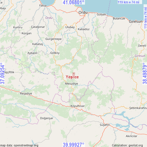
Yeşilce GPS coordinates[2]
40° 32' 8.772" North, 37° 47' 44.376" East
| Map corner | latitude | longitude |
|---|---|---|
| Upper-left | 41.06801°, | 37.09254° |
| Center: | 40.53577°, | 37.79566° |
| Lower-right: | 39.99927°, | 38.49879° |
| Map W x H: | 118.8×118.8 km | = 73.8×73.8mi |
| max Lat: | 42.02683° ⇑21.8% North |
| Yeşilce: | 40.53577° |
| min Lat: | ⇓78.2% South 35.9025° |
| min Long | Yeşilce | max Long |
| 25.90902° | 37.79566° | 44.60099° |
| W 60.5%⇐ | ⇒39.5% E |
Elevation
Elevation of Yeşilce is 1379 m = 4524 ft, and this is 661.6 m = 2171 ft above average elevation for this country.
| Max E: |
2682 m = 8799 ft | 12.6% |
| Yeşilce | 1379 m 4524 ft | |
| Avg. | 717.4 m = 2354 ft | |
Min E: |
0 m = 0 ft | 87.4% |
See also: Turkey elevation on elevation.city.
Geographical zone
Yeşilce is located in North temperate zone (between Tropic of Cancer and the Arctic Circle). Distance of this Northern Tropic circle is 1901.2 km =1181.4 mi to South.| Distance of | km | miles | from Yeşilce |
|---|---|---|---|
| North Pole | 5499.9 | 3417.5 | to North |
| Arctic Circle | 2894 | 1798.2 | to North |
| Tropic Cancer | 1901.2 | 1181.4 | to South |
| Equator | 4507.2 | 2800.6 | to South |


Nearby cities:
15 places around Yeşilce: (largest is in red/bold)
• Aybastı
37.4 km =23.2 mi,  296°
296°
• Doğanşar
42.7 km =26.5 mi,  211°
211°
• Gökçekent
38.9 km =24.2 mi,  135°
135°
• Gölköy
22.7 km =14.1 mi,  317°
317°
• Gürgentepe
32.8 km =20.4 mi,  327°
327°
• Kabadüz
36.9 km =22.9 mi,  11°
11°
• Kabataş
37.7 km =23.4 mi,  309°
309°
• Kovanlık
36.1 km =22.4 mi,  47°
47°
• Koyulhisar
26.1 km =16.2 mi,  174°
174°
• Mesudiye
9.2 km =5.7 mi,  191°
191°
• Ortakent
24.1 km =15 mi,  131°
131°
• Reşadiye
41.9 km =26 mi,  247°
247°
• Topçam
9.2 km =5.7 mi,  346°
346°
• Ulubey
37.2 km =23.1 mi, 354°
• Uzunisa
42.4 km =26.3 mi, 5°
Sources, notices
• [Note1] Compared only with cities in Turkey existing in our database
• [Src1] Map data: © OpenStreetMap contributors (CC-BY-SA)
• [Src2] Other city data from geonames.org with taken over terms of usage.
• [Src3] Geographical zone / Annual Mean Temperature by Robert A. Rohde @ Wikipedia
