Uzunisa geodata
Uzunisa (Ordu) is a seat of a third-order administrative division; located in Turkey in Europe/Istanbul (GMT+3) time zone. In our database, there are 1323 cities with bigger population. Compared to other cities in Turkey, 86.5% of cities are located further ↓South; 60.7% of cities are located further ←West and 76.9% of cities have higher elevation than Uzunisa. Note1


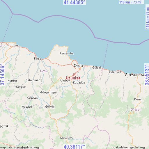
Uzunisa GPS coordinates[2]
40° 54' 52.74" North, 37° 50' 53.448" East
| Map corner | latitude | longitude |
|---|---|---|
| Upper-left | 41.44385°, | 37.14506° |
| Center: | 40.91465°, | 37.84818° |
| Lower-right: | 40.38117°, | 38.55131° |
| Map W x H: | 118.2×118.2 km | = 73.4×73.4mi |
| max Lat: | 42.02683° ⇑13.5% North |
| Uzunisa: | 40.91465° |
| min Lat: | ⇓86.5% South 35.9025° |
| min Long | Uzunisa | max Long |
| 25.90902° | 37.84818° | 44.60099° |
| W 60.7%⇐ | ⇒39.3% E |
Elevation
Elevation of Uzunisa is 151 m = 495 ft, and this is 566.4 m = 1858 ft below average elevation for this country.
| Max E: |
2682 m = 8799 ft | 76.9% |
| Avg. | 717.4 m = 2354 ft | |
| Uzunisa | 151 m = 495 ft | |
Min E: |
0 m = 0 ft | 23.1% |
See also: Turkey elevation on elevation.city.
Geographical zone
Uzunisa is located in North temperate zone (between Tropic of Cancer and the Arctic Circle). Distance of this Northern Tropic circle is 1943.4 km =1207.6 mi to South.| Distance of | km | miles | from Uzunisa |
|---|---|---|---|
| North Pole | 5457.8 | 3391.3 | to North |
| Arctic Circle | 2851.9 | 1772.1 | to North |
| Tropic Cancer | 1943.4 | 1207.6 | to South |
| Equator | 4549.3 | 2826.8 | to South |


Nearby cities:
15 places around Uzunisa: (largest is in red/bold)
• Altınordu
8 km =5 mi,  15°
15°
• Bolaman
25.1 km =15.6 mi,  301°
301°
• Bulancak
32.3 km =20.1 mi,  85°
85°
• Fatsa
31.7 km =19.7 mi,  293°
293°
• Gölköy
32 km =19.9 mi,  217°
217°
• Gülyalı
17.7 km =11 mi,  72°
72°
• Gürgentepe
26 km =16.2 mi,  236°
236°
• Kabadüz
6.7 km =4.2 mi,  152°
152°
• Kovanlık
28.4 km =17.6 mi,  128°
128°
• Ordu
7.9 km =4.9 mi,  26°
26°
• Perşembe
18 km =11.2 mi,  338°
338°
• Piraziz
22.3 km =13.9 mi,  78°
78°
• Piraziz
23.2 km =14.4 mi, 87°
• Ulubey
9.4 km =5.8 mi, 237°
• Çamaş
27 km =16.8 mi,  267°
267°
Sources, notices
• [Note1] Compared only with cities in Turkey existing in our database
• [Src1] Map data: © OpenStreetMap contributors (CC-BY-SA)
• [Src2] Other city data from geonames.org with taken over terms of usage.
• [Src3] Geographical zone / Annual Mean Temperature by Robert A. Rohde @ Wikipedia
