Selim geodata
Selim (Kars) is a seat of a second-order administrative division; located in Turkey in Europe/Istanbul (GMT+3) time zone. With population of 4,557 people, there are 752 cities with bigger population in this country. Compared to other cities in Turkey, 76.9% of cities are located further ↓South; 95.6% of cities are located further ←West and 97.9% of cities have lower elevation than Selim. Note1


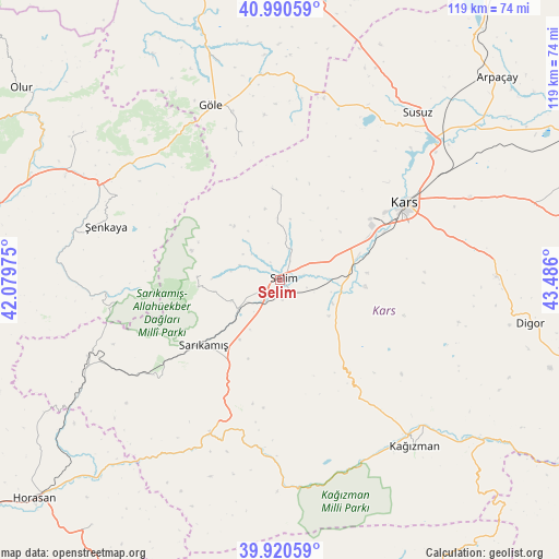
Selim GPS coordinates[2]
40° 27' 27.792" North, 42° 46' 58.332" East
| Map corner | latitude | longitude |
|---|---|---|
| Upper-left | 40.99059°, | 42.07975° |
| Center: | 40.45772°, | 42.78287° |
| Lower-right: | 39.92059°, | 43.486° |
| Map W x H: | 119×119 km | = 73.9×73.9mi |
| max Lat: | 42.02683° ⇑23.1% North |
| Selim: | 40.45772° |
| min Lat: | ⇓76.9% South 35.9025° |
| min Long | Selim | max Long |
| 25.90902° | 42.78287° | 44.60099° |
| W 95.6%⇐ | ⇒4.4% E |
Elevation
Elevation of Selim is 1853 m = 6079 ft, and this is 1135.6 m = 3726 ft above average elevation for this country.
| Max E: |
2682 m = 8799 ft | 2.1% |
| Selim | 1853 m 6079 ft | |
| Avg. | 717.4 m = 2354 ft | |
Min E: |
0 m = 0 ft | 97.9% |
See also: Turkey elevation on elevation.city.
Geographical zone
Selim is located in North temperate zone (between Tropic of Cancer and the Arctic Circle). Distance of this Northern Tropic circle is 1892.6 km =1176 mi to South.| Distance of | km | miles | from Selim |
|---|---|---|---|
| North Pole | 5508.6 | 3422.9 | to North |
| Arctic Circle | 2902.7 | 1803.7 | to North |
| Tropic Cancer | 1892.6 | 1176 | to South |
| Equator | 4498.5 | 2795.2 | to South |


Nearby cities:
15 places around Selim: (largest is in red/bold)
• Akşar
43 km =26.7 mi,  299°
299°
• Digor
54 km =33.6 mi,  100°
100°
• Gaziler
37 km =23 mi,  263°
263°
• Göle
39.6 km =24.6 mi,  337°
337°
• Hasköy
59.9 km =37.2 mi,  8°
8°
• Karakurt
35.8 km =22.2 mi,  204°
204°
• Karaurgan
49.6 km =30.8 mi,  240°
240°
• Kars
30 km =18.6 mi,  58°
58°
• Kağızman
44.8 km =27.8 mi,  138°
138°
• Kömürlü
51.9 km =32.2 mi,  306°
306°
• Kötek
32.5 km =20.2 mi,  145°
145°
• Sarıkamış
22 km =13.7 mi,  228°
228°
• Susuz
46.1 km =28.6 mi,  39°
39°
• Çiftlik
61.9 km =38.5 mi, 226°
• Şenkaya
38.8 km =24.1 mi,  286°
286°
Sources, notices
• [Note1] Compared only with cities in Turkey existing in our database
• [Src1] Map data: © OpenStreetMap contributors (CC-BY-SA)
• [Src2] Other city data from geonames.org with taken over terms of usage.
• [Src3] Geographical zone / Annual Mean Temperature by Robert A. Rohde @ Wikipedia
