Gaziler geodata
Gaziler (Erzurum) is a seat of a third-order administrative division; located in Turkey in Europe/Istanbul (GMT+3) time zone. In our database, there are 1323 cities with bigger population. Compared to other cities in Turkey, 76.6% of cities are located further ↓South; 93.3% of cities are located further ←West and 97.9% of cities have lower elevation than Gaziler. Note1


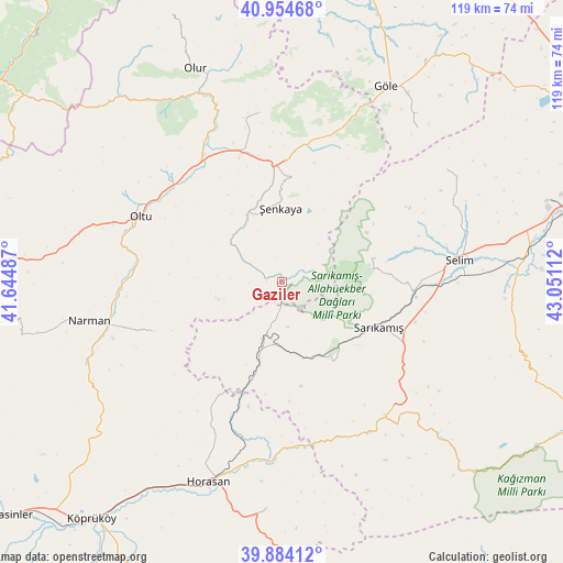
Gaziler GPS coordinates[2]
40° 25' 17.508" North, 42° 20' 52.764" East
| Map corner | latitude | longitude |
|---|---|---|
| Upper-left | 40.95468°, | 41.64487° |
| Center: | 40.42153°, | 42.34799° |
| Lower-right: | 39.88412°, | 43.05112° |
| Map W x H: | 119×119 km | = 73.9×73.9mi |
| max Lat: | 42.02683° ⇑23.4% North |
| Gaziler: | 40.42153° |
| min Lat: | ⇓76.6% South 35.9025° |
| min Long | Gaziler | max Long |
| 25.90902° | 42.34799° | 44.60099° |
| W 93.3%⇐ | ⇒6.7% E |
Elevation
Elevation of Gaziler is 1857 m = 6093 ft, and this is 1139.6 m = 3739 ft above average elevation for this country.
| Max E: |
2682 m = 8799 ft | 2.1% |
| Gaziler | 1857 m 6093 ft | |
| Avg. | 717.4 m = 2354 ft | |
Min E: |
0 m = 0 ft | 97.9% |
See also: Turkey elevation on elevation.city.
Geographical zone
Gaziler is located in North temperate zone (between Tropic of Cancer and the Arctic Circle). Distance of this Northern Tropic circle is 1888.5 km =1173.5 mi to South.| Distance of | km | miles | from Gaziler |
|---|---|---|---|
| North Pole | 5512.6 | 3425.4 | to North |
| Arctic Circle | 2906.7 | 1806.1 | to North |
| Tropic Cancer | 1888.5 | 1173.5 | to South |
| Equator | 4494.5 | 2792.8 | to South |


Nearby cities:
15 places around Gaziler: (largest is in red/bold)
• Akşar
25 km =15.5 mi,  358°
358°
• Aras
48.3 km =30 mi,  184°
184°
• Göle
46.2 km =28.7 mi,  28°
28°
• Horasan
45.3 km =28.1 mi,  200°
200°
• Karakurt
35.8 km =22.2 mi,  142°
142°
• Karaurgan
21.2 km =13.2 mi, 197°
• Kömürlü
35.3 km =21.9 mi,  351°
351°
• Kışlaköy
29.7 km =18.5 mi,  248°
248°
• Narman
42.1 km =26.2 mi,  258°
258°
• Oltu
33.2 km =20.6 mi,  293°
293°
• Olur
48.1 km =29.9 mi,  337°
337°
• Sarıkamış
22.8 km =14.2 mi,  117°
117°
• Selim
37 km =23 mi,  83°
83°
• Çiftlik
39.6 km =24.6 mi,  191°
191°
• Şenkaya
15 km =9.3 mi, 358°
Sources, notices
• [Note1] Compared only with cities in Turkey existing in our database
• [Src1] Map data: © OpenStreetMap contributors (CC-BY-SA)
• [Src2] Other city data from geonames.org with taken over terms of usage.
• [Src3] Geographical zone / Annual Mean Temperature by Robert A. Rohde @ Wikipedia
