Ortaköy geodata
Ortaköy (Çorum) is a seat of a second-order administrative division; located in Turkey in Europe/Istanbul (GMT+3) time zone. In our database, there are 1323 cities with bigger population. Compared to other cities in Turkey, 74% of cities are located further ↓South; 53.2% of cities are located further →East and 56.1% of cities have lower elevation than Ortaköy. Note1


Ortaköy GPS coordinates[2]
40° 16' 24.672" North, 35° 15' 6.3" East
| Map corner | latitude | longitude |
|---|---|---|
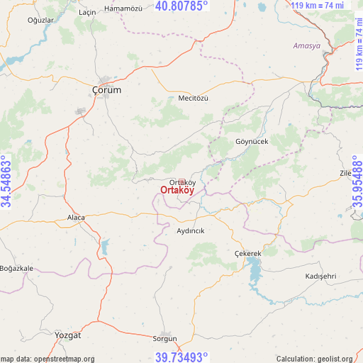
| Upper-left | 40.80785°, | 34.54863° |
| Center: | 40.27352°, | 35.25175° |
| Lower-right: | 39.73493°, | 35.95488° |
| Map W x H: | 119.3×119.3 km | = 74.1×74.1mi |
| max Lat: | 42.02683° ⇑26% North |
| Ortaköy: | 40.27352° |
| min Lat: | ⇓74% South 35.9025° |
| min Long | Ortaköy | max Long |
| 25.90902° | 35.25175° | 44.60099° |
| W 46.8%⇐ | ⇒53.2% E |
Elevation
Elevation of Ortaköy is 812 m = 2664 ft, and this is 94.6 m = 310 ft above average elevation for this country.
| Max E: |
2682 m = 8799 ft | 43.9% |
| Ortaköy | 812 m 2664 ft | |
| Avg. | 717.4 m = 2354 ft | |
Min E: |
0 m = 0 ft | 56.1% |
See also: Turkey elevation on elevation.city.
Geographical zone
Ortaköy is located in North temperate zone (between Tropic of Cancer and the Arctic Circle). Distance of this Northern Tropic circle is 1872.1 km =1163.3 mi to South.| Distance of | km | miles | from Ortaköy |
|---|---|---|---|
| North Pole | 5529.1 | 3435.6 | to North |
| Arctic Circle | 2923.2 | 1816.4 | to North |
| Tropic Cancer | 1872.1 | 1163.3 | to South |
| Equator | 4478 | 2782.5 | to South |


Nearby cities:
15 places around Ortaköy: (largest is in red/bold)
• Alaca
36.7 km =22.8 mi,  251°
251°
• Aydıncık
16.5 km =10.3 mi,  169°
169°
• Boztepe
54.8 km =34.1 mi,  100°
100°
• Cemilbey
18.8 km =11.7 mi,  295°
295°
• Doğantepe
46.8 km =29.1 mi,  39°
39°
• Eymir
28.5 km =17.7 mi,  187°
187°
• Gediksaray
37 km =23 mi,  58°
58°
• Göynücek
27 km =16.8 mi, 58°
• Mecitözü
27.7 km =17.2 mi,  7°
7°
• Seydim
52.8 km =32.8 mi, 304°
• Sorgun
51.8 km =32.2 mi, 186°
• Zile
53.9 km =33.5 mi,  86°
86°
• Çekerek
30.4 km =18.9 mi,  137°
137°
• Çorum
39.7 km =24.7 mi,  320°
320°
• İğdir
31.8 km =19.8 mi, 91°
Sources, notices
• [Note1] Compared only with cities in Turkey existing in our database
• [Src1] Map data: © OpenStreetMap contributors (CC-BY-SA)
• [Src2] Other city data from geonames.org with taken over terms of usage.
• [Src3] Geographical zone / Annual Mean Temperature by Robert A. Rohde @ Wikipedia
