Cemilbey geodata
Cemilbey (Çorum) is a seat of a third-order administrative division; located in Turkey in Europe/Istanbul (GMT+3) time zone. In our database, there are 1323 cities with bigger population. Compared to other cities in Turkey, 75.2% of cities are located further ↓South; 54.2% of cities are located further →East and 50.7% of cities have lower elevation than Cemilbey. Note1


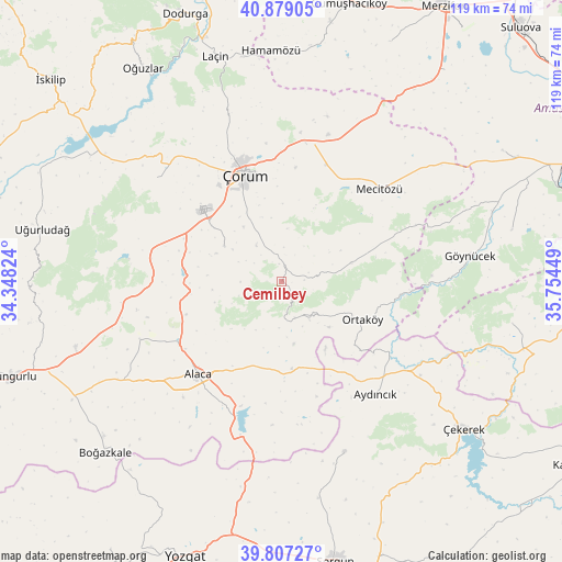
Cemilbey GPS coordinates[2]
40° 20' 43.044" North, 35° 3' 4.896" East
| Map corner | latitude | longitude |
|---|---|---|
| Upper-left | 40.87905°, | 34.34824° |
| Center: | 40.34529°, | 35.05136° |
| Lower-right: | 39.80727°, | 35.75449° |
| Map W x H: | 119.2×119.2 km | = 74.1×74.1mi |
| max Lat: | 42.02683° ⇑24.8% North |
| Cemilbey: | 40.34529° |
| min Lat: | ⇓75.2% South 35.9025° |
| min Long | Cemilbey | max Long |
| 25.90902° | 35.05136° | 44.60099° |
| W 45.8%⇐ | ⇒54.2% E |
Elevation
Elevation of Cemilbey is 706 m = 2316 ft, and this is 11.4 m = 37 ft below average elevation for this country.
| Max E: |
2682 m = 8799 ft | 49.3% |
| Avg. | 717.4 m = 2354 ft | |
| Cemilbey | 706 m = 2316 ft | |
Min E: |
0 m = 0 ft | 50.7% |
See also: Turkey elevation on elevation.city.
Geographical zone
Cemilbey is located in North temperate zone (between Tropic of Cancer and the Arctic Circle). Distance of this Northern Tropic circle is 1880.1 km =1168.2 mi to South.| Distance of | km | miles | from Cemilbey |
|---|---|---|---|
| North Pole | 5521.1 | 3430.7 | to North |
| Arctic Circle | 2915.2 | 1811.4 | to North |
| Tropic Cancer | 1880.1 | 1168.2 | to South |
| Equator | 4486 | 2787.5 | to South |


Nearby cities:
15 places around Cemilbey: (largest is in red/bold)
• Alaca
26.5 km =16.5 mi,  222°
222°
• Aydıncık
31.5 km =19.6 mi,  140°
140°
• Dedeköy
44.7 km =27.8 mi,  359°
359°
• Eymir
38.6 km =24 mi,  159°
159°
• Gediksaray
49.9 km =31 mi,  77°
77°
• Göynücek
40.6 km =25.2 mi, 81°
• Hamamözü
48.9 km =30.4 mi, 357°
• Laçin
49.9 km =31 mi,  343°
343°
• Mecitözü
28.3 km =17.6 mi,  46°
46°
• Ortaköy
18.8 km =11.7 mi,  115°
115°
• Seydim
34.4 km =21.4 mi,  309°
309°
• Uğurludağ
51.9 km =32.2 mi,  282°
282°
• Çekerek
48.3 km =30 mi,  128°
128°
• Çorum
24.1 km =15 mi, 339°
• İğdir
49.5 km =30.8 mi,  100°
100°
Sources, notices
• [Note1] Compared only with cities in Turkey existing in our database
• [Src1] Map data: © OpenStreetMap contributors (CC-BY-SA)
• [Src2] Other city data from geonames.org with taken over terms of usage.
• [Src3] Geographical zone / Annual Mean Temperature by Robert A. Rohde @ Wikipedia
