Seydim geodata
Seydim (Çorum) is a seat of a third-order administrative division; located in Turkey in Europe/Istanbul (GMT+3) time zone. In our database, there are 1323 cities with bigger population. Compared to other cities in Turkey, 78.3% of cities are located further ↓South; 55.5% of cities are located further →East and 80.1% of cities have lower elevation than Seydim. Note1


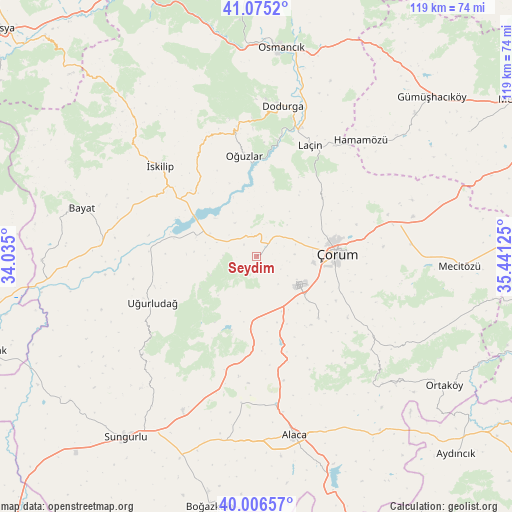
Seydim GPS coordinates[2]
40° 32' 34.872" North, 34° 44' 17.232" East
| Map corner | latitude | longitude |
|---|---|---|
| Upper-left | 41.0752°, | 34.035° |
| Center: | 40.54302°, | 34.73812° |
| Lower-right: | 40.00657°, | 35.44125° |
| Map W x H: | 118.8×118.8 km | = 73.8×73.8mi |
| max Lat: | 42.02683° ⇑21.7% North |
| Seydim: | 40.54302° |
| min Lat: | ⇓78.3% South 35.9025° |
| min Long | Seydim | max Long |
| 25.90902° | 34.73812° | 44.60099° |
| W 44.5%⇐ | ⇒55.5% E |
Elevation
Elevation of Seydim is 1195 m = 3921 ft, and this is 477.6 m = 1567 ft above average elevation for this country.
| Max E: |
2682 m = 8799 ft | 19.9% |
| Seydim | 1195 m 3921 ft | |
| Avg. | 717.4 m = 2354 ft | |
Min E: |
0 m = 0 ft | 80.1% |
See also: Turkey elevation on elevation.city.
Geographical zone
Seydim is located in North temperate zone (between Tropic of Cancer and the Arctic Circle). Distance of this Northern Tropic circle is 1902 km =1181.8 mi to South.| Distance of | km | miles | from Seydim |
|---|---|---|---|
| North Pole | 5499.1 | 3417 | to North |
| Arctic Circle | 2893.2 | 1797.8 | to North |
| Tropic Cancer | 1902 | 1181.8 | to South |
| Equator | 4508 | 2801.1 | to South |


Nearby cities:
15 places around Seydim: (largest is in red/bold)
• Alaca
42.6 km =26.5 mi,  168°
168°
• Bayat
41.8 km =26 mi,  285°
285°
• Cemilbey
34.4 km =21.4 mi,  129°
129°
• Dedeköy
34.3 km =21.3 mi,  48°
48°
• Dodurga
35.2 km =21.9 mi,  9°
9°
• Gümüş
49.3 km =30.6 mi, 47°
• Hamamözü
36.2 km =22.5 mi,  42°
42°
• Laçin
28.4 km =17.6 mi,  25°
25°
• Mecitözü
47.2 km =29.3 mi,  93°
93°
• Osmancık
48.7 km =30.3 mi, 6°
• Oğuzlar
23.6 km =14.7 mi,  352°
352°
• Sungurlu
51.9 km =32.2 mi,  216°
216°
• Uğurludağ
26.4 km =16.4 mi,  245°
245°
• Çorum
18.2 km =11.3 mi, 87°
• İskilip
30.9 km =19.2 mi,  313°
313°
Sources, notices
• [Note1] Compared only with cities in Turkey existing in our database
• [Src1] Map data: © OpenStreetMap contributors (CC-BY-SA)
• [Src2] Other city data from geonames.org with taken over terms of usage.
• [Src3] Geographical zone / Annual Mean Temperature by Robert A. Rohde @ Wikipedia
