Yarhisar geodata
Yarhisar (Bilecik) is a seat of a third-order administrative division; located in Turkey in Europe/Istanbul (GMT+3) time zone. In our database, there are 1323 cities with bigger population. Compared to other cities in Turkey, 73% of cities are located further ↓South; 76.6% of cities are located further →East and 54.4% of cities have higher elevation than Yarhisar. Note1


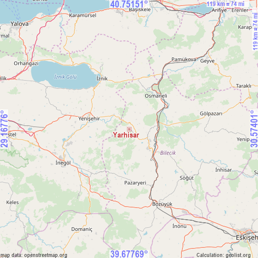
Yarhisar GPS coordinates[2]
40° 13' 0.228" North, 29° 52' 15.168" East
| Map corner | latitude | longitude |
|---|---|---|
| Upper-left | 40.75151°, | 29.16776° |
| Center: | 40.21673°, | 29.87088° |
| Lower-right: | 39.67769°, | 30.57401° |
| Map W x H: | 119.4×119.4 km | = 74.2×74.2mi |
| max Lat: | 42.02683° ⇑27% North |
| Yarhisar: | 40.21673° |
| min Lat: | ⇓73% South 35.9025° |
| min Long | Yarhisar | max Long |
| 25.90902° | 29.87088° | 44.60099° |
| W 23.4%⇐ | ⇒76.6% E |
Elevation
Elevation of Yarhisar is 604 m = 1982 ft, and this is 113.4 m = 372 ft below average elevation for this country.
| Max E: |
2682 m = 8799 ft | 54.4% |
| Avg. | 717.4 m = 2354 ft | |
| Yarhisar | 604 m = 1982 ft | |
Min E: |
0 m = 0 ft | 45.6% |
See also: Turkey elevation on elevation.city.
Geographical zone
Yarhisar is located in North temperate zone (between Tropic of Cancer and the Arctic Circle). Distance of this Northern Tropic circle is 1865.8 km =1159.4 mi to South.| Distance of | km | miles | from Yarhisar |
|---|---|---|---|
| North Pole | 5535.4 | 3439.5 | to North |
| Arctic Circle | 2929.5 | 1820.3 | to North |
| Tropic Cancer | 1865.8 | 1159.4 | to South |
| Equator | 4471.7 | 2778.6 | to South |


Nearby cities:
15 places around Yarhisar: (largest is in red/bold)
• Alanyurt
32.2 km =20 mi,  248°
248°
• Balarim
29.5 km =18.3 mi,  306°
306°
• Bilecik
12.4 km =7.7 mi,  132°
132°
• Dırazali
24.3 km =15.1 mi,  325°
325°
• Elbeyli
32.4 km =20.1 mi,  337°
337°
• Hamzabey
30.6 km =19 mi, 252°
• Kaynarca
22.3 km =13.9 mi,  350°
350°
• Kurşunlu
26.9 km =16.7 mi,  221°
221°
• Küplü
17.1 km =10.6 mi,  140°
140°
• Osmaneli
19.8 km =12.3 mi,  37°
37°
• Pazaryeri
24.9 km =15.5 mi,  173°
173°
• Sansarak
30.4 km =18.9 mi, 353°
• Vezirhan
13 km =8.1 mi,  76°
76°
• Yenişehir
19.2 km =11.9 mi,  286°
286°
• İznik
26.8 km =16.7 mi, 331°
Sources, notices
• [Note1] Compared only with cities in Turkey existing in our database
• [Src1] Map data: © OpenStreetMap contributors (CC-BY-SA)
• [Src2] Other city data from geonames.org with taken over terms of usage.
• [Src3] Geographical zone / Annual Mean Temperature by Robert A. Rohde @ Wikipedia
