İbriktepe geodata
İbriktepe (Edirne) is a seat of a third-order administrative division; located in Turkey in Europe/Istanbul (GMT+3) time zone. In our database, there are 1323 cities with bigger population. Compared to other cities in Turkey, 89.2% of cities are located further ↓South; 99.1% of cities are located further →East and 79.4% of cities have higher elevation than İbriktepe. Note1


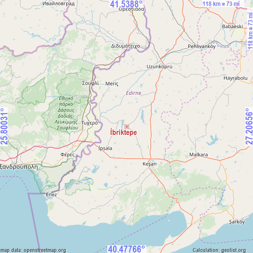
İbriktepe GPS coordinates[2]
41° 0' 37.332" North, 26° 30' 12.348" East
| Map corner | latitude | longitude |
|---|---|---|
| Upper-left | 41.5388°, | 25.80031° |
| Center: | 41.01037°, | 26.50343° |
| Lower-right: | 40.47766°, | 27.20656° |
| Map W x H: | 118×118 km | = 73.3×73.3mi |
| max Lat: | 42.02683° ⇑10.8% North |
| İbriktepe: | 41.01037° |
| min Lat: | ⇓89.2% South 35.9025° |
| min Long | İbriktepe | max Long |
| 25.90902° | 26.50343° | 44.60099° |
| W 0.9%⇐ | ⇒99.1% E |
Elevation
Elevation of İbriktepe is 120 m = 394 ft, and this is 597.4 m = 1960 ft below average elevation for this country.
| Max E: |
2682 m = 8799 ft | 79.4% |
| Avg. | 717.4 m = 2354 ft | |
| İbriktepe | 120 m = 394 ft | |
Min E: |
0 m = 0 ft | 20.6% |
See also: Turkey elevation on elevation.city.
Geographical zone
İbriktepe is located in North temperate zone (between Tropic of Cancer and the Arctic Circle). Distance of this Northern Tropic circle is 1954 km =1214.2 mi to South.| Distance of | km | miles | from İbriktepe |
|---|---|---|---|
| North Pole | 5447.1 | 3384.7 | to North |
| Arctic Circle | 2841.2 | 1765.4 | to North |
| Tropic Cancer | 1954 | 1214.2 | to South |
| Equator | 4559.9 | 2833.4 | to South |


Nearby cities:
15 places around İbriktepe: (largest is in red/bold)
• Enez
47.6 km =29.6 mi,  228°
228°
• Evreşe
49.8 km =30.9 mi,  140°
140°
• Hamidiye
20.7 km =12.9 mi,  40°
40°
• Keşan
20.2 km =12.6 mi,  148°
148°
• Küplü
16.6 km =10.3 mi,  310°
310°
• Kırcasalih
48.8 km =30.3 mi,  30°
30°
• Malkara
36 km =22.4 mi,  111°
111°
• Mecidiye
41.4 km =25.7 mi,  175°
175°
• Meriç
21.3 km =13.2 mi,  341°
341°
• Susuzmüsellim
48.3 km =30 mi,  78°
78°
• Uzunköprü
32.4 km =20.1 mi, 28°
• Yürük
48 km =29.8 mi,  99°
99°
• Çöpköy
35.5 km =22.1 mi,  48°
48°
• İpsala
14.2 km =8.8 mi, 225°
• Şahin
28.5 km =17.7 mi,  87°
87°
Sources, notices
• [Note1] Compared only with cities in Turkey existing in our database
• [Src1] Map data: © OpenStreetMap contributors (CC-BY-SA)
• [Src2] Other city data from geonames.org with taken over terms of usage.
• [Src3] Geographical zone / Annual Mean Temperature by Robert A. Rohde @ Wikipedia
