Şahin geodata
Şahin (Tekirdağ) is a seat of a third-order administrative division; located in Turkey in Europe/Istanbul (GMT+3) time zone. In our database, there are 1323 cities with bigger population. Compared to other cities in Turkey, 90% of cities are located further ↓South; 97.7% of cities are located further →East and 72.5% of cities have higher elevation than Şahin. Note1


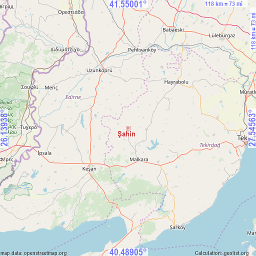
Şahin GPS coordinates[2]
41° 1' 18.012" North, 26° 50' 33" East
| Map corner | latitude | longitude |
|---|---|---|
| Upper-left | 41.55001°, | 26.13938° |
| Center: | 41.02167°, | 26.8425° |
| Lower-right: | 40.48905°, | 27.54563° |
| Map W x H: | 118×118 km | = 73.3×73.3mi |
| max Lat: | 42.02683° ⇑10% North |
| Şahin: | 41.02167° |
| min Lat: | ⇓90% South 35.9025° |
| min Long | Şahin | max Long |
| 25.90902° | 26.8425° | 44.60099° |
| W 2.3%⇐ | ⇒97.7% E |
Elevation
Elevation of Şahin is 223 m = 732 ft, and this is 494.4 m = 1622 ft below average elevation for this country.
| Max E: |
2682 m = 8799 ft | 72.5% |
| Avg. | 717.4 m = 2354 ft | |
| Şahin | 223 m = 732 ft | |
Min E: |
0 m = 0 ft | 27.5% |
See also: Turkey elevation on elevation.city.
Geographical zone
Şahin is located in North temperate zone (between Tropic of Cancer and the Arctic Circle). Distance of this Northern Tropic circle is 1955.3 km =1215 mi to South.| Distance of | km | miles | from Şahin |
|---|---|---|---|
| North Pole | 5445.9 | 3383.9 | to North |
| Arctic Circle | 2840 | 1764.7 | to North |
| Tropic Cancer | 1955.3 | 1215 | to South |
| Equator | 4561.2 | 2834.2 | to South |


Nearby cities:
15 places around Şahin: (largest is in red/bold)
• Ballı
27.8 km =17.3 mi,  139°
139°
• Evreşe
39.6 km =24.6 mi,  175°
175°
• Hamidiye
20.8 km =12.9 mi,  313°
313°
• Hayrabolu
30.7 km =19.1 mi,  46°
46°
• Keşan
25.6 km =15.9 mi,  224°
224°
• Malkara
15.4 km =9.6 mi,  161°
161°
• Meriç
40.1 km =24.9 mi,  298°
298°
• Pehlivanköy
37 km =23 mi,  10°
10°
• Susuzmüsellim
20.7 km =12.9 mi,  65°
65°
• Uzunköprü
30.1 km =18.7 mi,  334°
334°
• Yürük
21.1 km =13.1 mi,  117°
117°
• Çöpköy
22.1 km =13.7 mi,  355°
355°
• İbriktepe
28.5 km =17.7 mi,  267°
267°
• İnecik
38.1 km =23.7 mi,  104°
104°
• İpsala
40.2 km =25 mi,  253°
253°
Sources, notices
• [Note1] Compared only with cities in Turkey existing in our database
• [Src1] Map data: © OpenStreetMap contributors (CC-BY-SA)
• [Src2] Other city data from geonames.org with taken over terms of usage.
• [Src3] Geographical zone / Annual Mean Temperature by Robert A. Rohde @ Wikipedia
