Hopa geodata
Hopa (Artvin) is a seat of a second-order administrative division; located in Turkey in Europe/Istanbul (GMT+3) time zone. With population of 17,519 people, there are 355 cities with bigger population in this country. Compared to other cities in Turkey, 96.3% of cities are located further ↓South; 85.7% of cities are located further ←West and 96.2% of cities have higher elevation than Hopa. Note1


Hopa GPS coordinates[2]
41° 23' 25.656" North, 41° 25' 10.776" East
| Map corner | latitude | longitude |
|---|---|---|
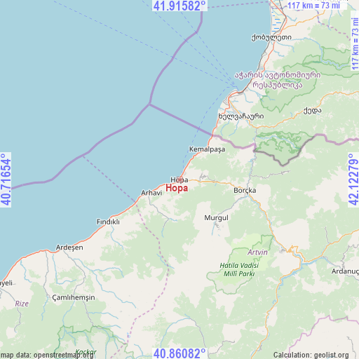
| Upper-left | 41.91582°, | 40.71654° |
| Center: | 41.39046°, | 41.41966° |
| Lower-right: | 40.86082°, | 42.12279° |
| Map W x H: | 117.3×117.3 km | = 72.9×72.9mi |
| max Lat: | 42.02683° ⇑3.7% North |
| Hopa: | 41.39046° |
| min Lat: | ⇓96.3% South 35.9025° |
| min Long | Hopa | max Long |
| 25.90902° | 41.41966° | 44.60099° |
| W 85.7%⇐ | ⇒14.3% E |
Elevation
Elevation of Hopa is 13 m = 43 ft, and this is 704.4 m = 2311 ft below average elevation for this country.
| Max E: |
2682 m = 8799 ft | 96.2% |
| Avg. | 717.4 m = 2354 ft | |
| Hopa | 13 m = 43 ft | |
Min E: |
0 m = 0 ft | 3.8% |
See also: Turkey elevation on elevation.city.
Geographical zone
Hopa is located in North temperate zone (between Tropic of Cancer and the Arctic Circle). Distance of this Northern Tropic circle is 1996.3 km =1240.4 mi to South.| Distance of | km | miles | from Hopa |
|---|---|---|---|
| North Pole | 5404.9 | 3358.4 | to North |
| Arctic Circle | 2799 | 1739.2 | to North |
| Tropic Cancer | 1996.3 | 1240.4 | to South |
| Equator | 4602.2 | 2859.7 | to South |


Nearby cities:
15 places around Hopa: (largest is in red/bold)
• Ardeşen
42.4 km =26.3 mi,  238°
238°
• Arhavi
10.5 km =6.5 mi,  245°
245°
• Artvin
40.8 km =25.4 mi,  124°
124°
• Borçka
20.9 km =13 mi,  99°
99°
• Camili
41.1 km =25.5 mi,  76°
76°
• Fındıklı
27 km =16.8 mi, 239°
• Kemalpaşa
13.7 km =8.5 mi,  41°
41°
• Muratlı
25.7 km =16 mi,  68°
68°
• Murgul
16.7 km =10.4 mi,  137°
137°
• Ortacalar
12.9 km =8 mi,  195°
195°
• Ortaköy
49.6 km =30.8 mi,  108°
108°
• Pazar
50.5 km =31.4 mi, 242°
• Seyitler
41.1 km =25.5 mi, 121°
• Zeytinlik
48.1 km =29.9 mi,  130°
130°
• Zigopor
49.7 km =30.9 mi,  172°
172°
Sources, notices
• [Note1] Compared only with cities in Turkey existing in our database
• [Src1] Map data: © OpenStreetMap contributors (CC-BY-SA)
• [Src2] Other city data from geonames.org with taken over terms of usage.
• [Src3] Geographical zone / Annual Mean Temperature by Robert A. Rohde @ Wikipedia
