Armutlu geodata
Armutlu (Yalova) is a seat of a second-order administrative division; located in Turkey in Europe/Istanbul (GMT+3) time zone. In our database, there are 1323 cities with bigger population. Compared to other cities in Turkey, 77.9% of cities are located further ↓South; 85.4% of cities are located further →East and 95.9% of cities have higher elevation than Armutlu. Note1


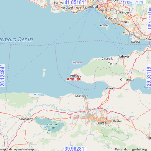
Armutlu GPS coordinates[2]
40° 31' 9.984" North, 28° 49' 41.016" East
| Map corner | latitude | longitude |
|---|---|---|
| Upper-left | 41.05181°, | 28.12494° |
| Center: | 40.51944°, | 28.82806° |
| Lower-right: | 39.98281°, | 29.53119° |
| Map W x H: | 118.9×118.9 km | = 73.9×73.9mi |
| max Lat: | 42.02683° ⇑22.1% North |
| Armutlu: | 40.51944° |
| min Lat: | ⇓77.9% South 35.9025° |
| min Long | Armutlu | max Long |
| 25.90902° | 28.82806° | 44.60099° |
| W 14.6%⇐ | ⇒85.4% E |
Elevation
Elevation of Armutlu is 14 m = 46 ft, and this is 703.4 m = 2308 ft below average elevation for this country.
| Max E: |
2682 m = 8799 ft | 95.9% |
| Avg. | 717.4 m = 2354 ft | |
| Armutlu | 14 m = 46 ft | |
Min E: |
0 m = 0 ft | 4.1% |
See also: Turkey elevation on elevation.city.
Geographical zone
Armutlu is located in North temperate zone (between Tropic of Cancer and the Arctic Circle). Distance of this Northern Tropic circle is 1899.4 km =1180.2 mi to South.| Distance of | km | miles | from Armutlu |
|---|---|---|---|
| North Pole | 5501.7 | 3418.6 | to North |
| Arctic Circle | 2895.8 | 1799.4 | to North |
| Tropic Cancer | 1899.4 | 1180.2 | to South |
| Equator | 4505.3 | 2799.5 | to South |


Nearby cities:
15 places around Armutlu: (largest is in red/bold)
• Demirtaş
35.8 km =22.2 mi,  140°
140°
• Gemlik
29.7 km =18.5 mi,  109°
109°
• Görükle
32.1 km =19.9 mi,  178°
178°
• Kadıköy
35.4 km =22 mi,  71°
71°
• Karacaali
20.8 km =12.9 mi,  102°
102°
• Kocadere
21 km =13 mi,  54°
54°
• Koruköy
32 km =19.9 mi,  62°
62°
• Küçükkumla
23.8 km =14.8 mi, 103°
• Mahmudiye
25.2 km =15.7 mi,  216°
216°
• Mudanya
16.7 km =10.4 mi,  164°
164°
• Nilüfer
34.8 km =21.6 mi,  167°
167°
• Termal
30.8 km =19.1 mi, 71°
• Umurbey
32.2 km =20 mi, 111°
• Zeytinbağı
14.5 km =9 mi,  190°
190°
• Çınarcık
28.7 km =17.8 mi, 60°
Sources, notices
• [Note1] Compared only with cities in Turkey existing in our database
• [Src1] Map data: © OpenStreetMap contributors (CC-BY-SA)
• [Src2] Other city data from geonames.org with taken over terms of usage.
• [Src3] Geographical zone / Annual Mean Temperature by Robert A. Rohde @ Wikipedia
