Mto wa Mbu geodata
Mto wa Mbu (Arusha) is a populated place; located in Tanzania in Africa/Dar_es_Salaam (GMT+3) time zone. With population of 17,754 people, there are 154 cities with bigger population in this country. Compared to other cities in Tanzania, 78.7% of cities are located further ↓South; 57.3% of cities are located further ←West and 58.7% of cities have higher elevation than Mto wa Mbu. Note1


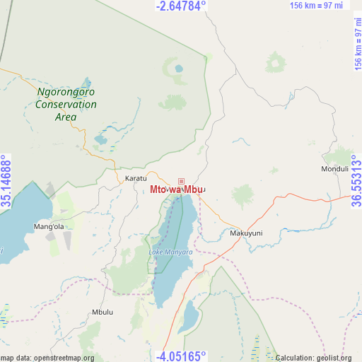
Mto wa Mbu GPS coordinates[2]
3° 21' 0" South, 35° 51' 0" East
| Map corner | latitude | longitude |
|---|---|---|
| Upper-left | -2.64784°, | 35.14688° |
| Center: | -3.35°, | 35.85° |
| Lower-right: | -4.05165°, | 36.55313° |
| Map W x H: | 156.1×156.1 km | = 97×97mi |
| max Lat: | -1.14389° ⇑21.3% North |
| Mto wa Mbu: | -3.35° |
| min Lat: | ⇓78.7% South -11.36667° |
| min Long | Mto wa Mbu | max Long |
| 29.62667° | 35.85° | 40.33333° |
| W 57.3%⇐ | ⇒42.7% E |
Elevation
Elevation of Mto wa Mbu is 985 m = 3232 ft, and this is 42.2 m = 138 ft above average elevation for this country.
| Max E: |
2377 m = 7799 ft | 58.7% |
| Mto wa Mbu | 985 m 3232 ft | |
| Avg. | 942.8 m = 3093 ft | |
Min E: |
0 m = 0 ft | 41.3% |
See also: Tanzania elevation on elevation.city.
Geographical zone
Mto wa Mbu is located in South Torrid zone (between Equator and Tropic of Capricorn). Distance of Equator is 372.5 km =231.5 mi to North.| Distance of | km | miles | from Mto wa Mbu |
|---|---|---|---|
| Equator | 372.5 | 231.5 | to North |
| Tropic Capricorn | 2233.4 | 1387.8 | to South |
| Antarctic Circle | 7028.7 | 4367.4 | to South |
| South Pole | 9634.6 | 5986.7 | to South |


Nearby cities:
15 places around Mto wa Mbu: (largest is in red/bold)
• Arusha
92.5 km =57.5 mi,  91°
91°
• Babati
97 km =60.3 mi,  186°
186°
• Bashanet
109.4 km =68 mi,  206°
206°
• Dareda
102 km =63.4 mi,  199°
199°
• Dongobesh
95 km =59 mi, 213°
• Galappo
101.9 km =63.3 mi,  180°
180°
• Kiratu
20.4 km =12.7 mi,  275°
275°
• Longido
116.5 km =72.4 mi,  53°
53°
• Magugu
74.7 km =46.4 mi, 187°
• Mbulu
65.8 km =40.9 mi, 212°
• Monduli
66.8 km =41.5 mi, 85°
• Ngorongoro
42.1 km =26.2 mi,  286°
286°
• Nkoaranga
105.5 km =65.6 mi, 88°
• Poli
105.5 km =65.6 mi, 88°
• Usa River
111 km =69 mi, 90°
Sources, notices
• [Note1] Compared only with cities in Tanzania existing in our database
• [Src1] Map data: © OpenStreetMap contributors (CC-BY-SA)
• [Src2] Other city data from geonames.org with taken over terms of usage.
• [Src3] Geographical zone / Annual Mean Temperature by Robert A. Rohde @ Wikipedia
