Nkoaranga geodata
Nkoaranga (Arusha) is a populated place; located in Tanzania in Africa/Dar_es_Salaam (GMT+3) time zone. With population of 14,738 people, there are 185 cities with bigger population in this country. Compared to other cities in Tanzania, 79.4% of cities are located further ↓South; 63.3% of cities are located further ←West and 92.3% of cities have lower elevation than Nkoaranga. Note1


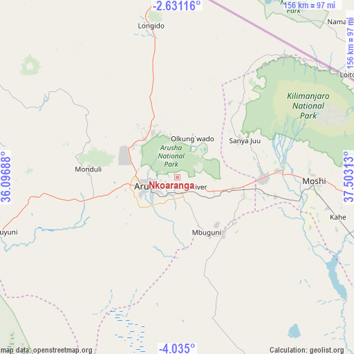
Nkoaranga GPS coordinates[2]
3° 19' 59.988" South, 36° 48' 0" East
| Map corner | latitude | longitude |
|---|---|---|
| Upper-left | -2.63116°, | 36.09688° |
| Center: | -3.33333°, | 36.8° |
| Lower-right: | -4.035°, | 37.50313° |
| Map W x H: | 156.1×156.1 km | = 97×97mi |
| max Lat: | -1.14389° ⇑20.6% North |
| Nkoaranga: | -3.33333° |
| min Lat: | ⇓79.4% South -11.36667° |
| min Long | Nkoaranga | max Long |
| 29.62667° | 36.8° | 40.33333° |
| W 63.3%⇐ | ⇒36.7% E |
Elevation
Elevation of Nkoaranga is 1644 m = 5394 ft, and this is 701.2 m = 2301 ft above average elevation for this country.
| Max E: |
2377 m = 7799 ft | 7.7% |
| Nkoaranga | 1644 m 5394 ft | |
| Avg. | 942.8 m = 3093 ft | |
Min E: |
0 m = 0 ft | 92.3% |
See also: Tanzania elevation on elevation.city.
Geographical zone
Nkoaranga is located in South Torrid zone (between Equator and Tropic of Capricorn). Distance of Equator is 370.6 km =230.3 mi to North.| Distance of | km | miles | from Nkoaranga |
|---|---|---|---|
| Equator | 370.6 | 230.3 | to North |
| Tropic Capricorn | 2235.3 | 1389 | to South |
| Antarctic Circle | 7030.5 | 4368.5 | to South |
| South Pole | 9636.4 | 5987.8 | to South |


Nearby cities:
15 places around Nkoaranga: (largest is in red/bold)
• Arusha
13.5 km =8.4 mi,  254°
254°
• Kingori
21.1 km =13.1 mi,  74°
74°
• Kirya
99.8 km =62 mi,  130°
130°
• Kwakoa
112.6 km =70 mi,  115°
115°
• Lembeni
103.5 km =64.3 mi, 118°
• Longido
67.7 km =42.1 mi,  350°
350°
• Mbuguni
30.8 km =19.1 mi,  147°
147°
• Merelani
32.2 km =20 mi,  141°
141°
• Monduli
39 km =24.2 mi,  275°
275°
• Moshi
59.2 km =36.8 mi,  91°
91°
• Mto wa Mbu
105.5 km =65.6 mi,  268°
268°
• Naberera
97.5 km =60.6 mi,  171°
171°
• Namanga
87 km =54.1 mi,  358°
358°
• Poli
0 km =0 mi,  0°
0°
• Usa River
6.7 km =4.2 mi, 123°
Sources, notices
• [Note1] Compared only with cities in Tanzania existing in our database
• [Src1] Map data: © OpenStreetMap contributors (CC-BY-SA)
• [Src2] Other city data from geonames.org with taken over terms of usage.
• [Src3] Geographical zone / Annual Mean Temperature by Robert A. Rohde @ Wikipedia
