Babati geodata
Babati (Manyara) is a seat of a first-order administrative division; located in Tanzania in Africa/Dar_es_Salaam (GMT+3) time zone. With population of 34,291 people, there are 50 cities with bigger population in this country. Compared to other cities in Tanzania, 67.5% of cities are located further ↓South; 55.6% of cities are located further ←West and 74.5% of cities have lower elevation than Babati. Note1


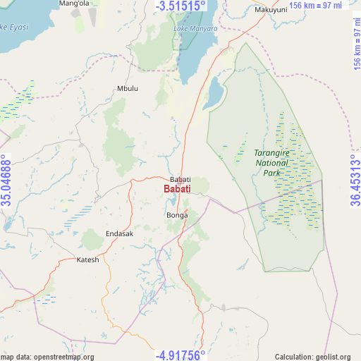
Babati GPS coordinates[2]
4° 13' 0.012" South, 35° 45' 0" East
| Map corner | latitude | longitude |
|---|---|---|
| Upper-left | -3.51515°, | 35.04688° |
| Center: | -4.21667°, | 35.75° |
| Lower-right: | -4.91756°, | 36.45313° |
| Map W x H: | 155.9×155.9 km | = 96.9×96.9mi |
| max Lat: | -1.14389° ⇑32.5% North |
| Babati: | -4.21667° |
| min Lat: | ⇓67.5% South -11.36667° |
| min Long | Babati | max Long |
| 29.62667° | 35.75° | 40.33333° |
| W 55.6%⇐ | ⇒44.4% E |
Elevation
Elevation of Babati is 1351 m = 4432 ft, and this is 408.2 m = 1339 ft above average elevation for this country.
| Max E: |
2377 m = 7799 ft | 25.5% |
| Babati | 1351 m 4432 ft | |
| Avg. | 942.8 m = 3093 ft | |
Min E: |
0 m = 0 ft | 74.5% |
See also: Tanzania elevation on elevation.city.
Geographical zone
Babati is located in South Torrid zone (between Equator and Tropic of Capricorn). Distance of Equator is 468.8 km =291.3 mi to North.| Distance of | km | miles | from Babati |
|---|---|---|---|
| Equator | 468.8 | 291.3 | to North |
| Tropic Capricorn | 2137.1 | 1327.9 | to South |
| Antarctic Circle | 6932.3 | 4307.5 | to South |
| South Pole | 9538.2 | 5926.8 | to South |


Nearby cities:
15 places around Babati: (largest is in red/bold)
• Bashanet
37 km =23 mi,  267°
267°
• Basotu
75.8 km =47.1 mi,  257°
257°
• Dareda
22.2 km =13.8 mi, 270°
• Dongobesh
44 km =27.3 mi,  292°
292°
• Endasak
34.1 km =21.2 mi,  229°
229°
• Galappo
12.4 km =7.7 mi,  116°
116°
• Ilongero
110 km =68.4 mi,  242°
242°
• Katesh
53 km =32.9 mi, 229°
• Kiratu
98.7 km =61.3 mi,  354°
354°
• Kondoa
76.1 km =47.3 mi,  177°
177°
• Magugu
22.3 km =13.9 mi,  4°
4°
• Mbulu
47.3 km =29.4 mi,  329°
329°
• Mtinko
106.4 km =66.1 mi,  249°
249°
• Mto wa Mbu
97 km =60.3 mi,  6°
6°
• Nangwa
43.3 km =26.9 mi, 230°
Sources, notices
• [Note1] Compared only with cities in Tanzania existing in our database
• [Src1] Map data: © OpenStreetMap contributors (CC-BY-SA)
• [Src2] Other city data from geonames.org with taken over terms of usage.
• [Src3] Geographical zone / Annual Mean Temperature by Robert A. Rohde @ Wikipedia
