Galappo geodata
Galappo (Manyara) is a populated place; located in Tanzania in Africa/Dar_es_Salaam (GMT+3) time zone. With population of 18,528 people, there are 146 cities with bigger population in this country. Compared to other cities in Tanzania, 66.1% of cities are located further ↓South; 57.3% of cities are located further ←West and 77.6% of cities have lower elevation than Galappo. Note1


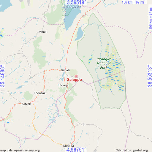
Galappo GPS coordinates[2]
4° 16' 0.012" South, 35° 51' 0" East
| Map corner | latitude | longitude |
|---|---|---|
| Upper-left | -3.56519°, | 35.14688° |
| Center: | -4.26667°, | 35.85° |
| Lower-right: | -4.96751°, | 36.55313° |
| Map W x H: | 155.9×155.9 km | = 96.9×96.9mi |
| max Lat: | -1.14389° ⇑33.9% North |
| Galappo: | -4.26667° |
| min Lat: | ⇓66.1% South -11.36667° |
| min Long | Galappo | max Long |
| 29.62667° | 35.85° | 40.33333° |
| W 57.3%⇐ | ⇒42.7% E |
Elevation
Elevation of Galappo is 1379 m = 4524 ft, and this is 436.2 m = 1431 ft above average elevation for this country.
| Max E: |
2377 m = 7799 ft | 22.4% |
| Galappo | 1379 m 4524 ft | |
| Avg. | 942.8 m = 3093 ft | |
Min E: |
0 m = 0 ft | 77.6% |
See also: Tanzania elevation on elevation.city.
Geographical zone
Galappo is located in South Torrid zone (between Equator and Tropic of Capricorn). Distance of Equator is 474.4 km =294.8 mi to North.| Distance of | km | miles | from Galappo |
|---|---|---|---|
| Equator | 474.4 | 294.8 | to North |
| Tropic Capricorn | 2131.5 | 1324.5 | to South |
| Antarctic Circle | 6926.8 | 4304.1 | to South |
| South Pole | 9532.7 | 5923.3 | to South |


Nearby cities:
15 places around Galappo: (largest is in red/bold)
• Babati
12.4 km =7.7 mi,  296°
296°
• Bashanet
48.2 km =30 mi,  274°
274°
• Basotu
85.7 km =53.3 mi,  262°
262°
• Dareda
33.7 km =20.9 mi,  279°
279°
• Dongobesh
56.3 km =35 mi,  293°
293°
• Endasak
40.5 km =25.2 mi,  245°
245°
• Ilongero
117.7 km =73.1 mi, 247°
• Katesh
59 km =36.7 mi,  240°
240°
• Kiratu
105.8 km =65.7 mi,  348°
348°
• Kondoa
70.8 km =44 mi,  185°
185°
• Magugu
29.3 km =18.2 mi,  341°
341°
• Mbulu
58.1 km =36.1 mi,  322°
322°
• Mtinko
115.2 km =71.6 mi, 254°
• Mto wa Mbu
101.9 km =63.3 mi,  0°
0°
• Nangwa
49.6 km =30.8 mi, 243°
Sources, notices
• [Note1] Compared only with cities in Tanzania existing in our database
• [Src1] Map data: © OpenStreetMap contributors (CC-BY-SA)
• [Src2] Other city data from geonames.org with taken over terms of usage.
• [Src3] Geographical zone / Annual Mean Temperature by Robert A. Rohde @ Wikipedia
