Kongwa geodata
Kongwa (Dodoma) is a populated place; located in Tanzania in Africa/Dar_es_Salaam (GMT+3) time zone. With population of 11,840 people, there are 216 cities with bigger population in this country. Compared to other cities in Tanzania, 58.4% of cities are located further ↑North; 59.8% of cities are located further ←West and 55.9% of cities have higher elevation than Kongwa. Note1


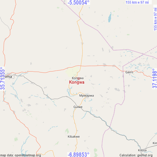
Kongwa GPS coordinates[2]
6° 12' 0" South, 36° 25' 0.012" East
| Map corner | latitude | longitude |
|---|---|---|
| Upper-left | -5.50054°, | 35.71355° |
| Center: | -6.2°, | 36.41667° |
| Lower-right: | -6.89853°, | 37.1198° |
| Map W x H: | 155.4×155.4 km | = 96.6×96.6mi |
| max Lat: | -1.14389° ⇑58.4% North |
| Kongwa: | -6.2° |
| min Lat: | ⇓41.6% South -11.36667° |
| min Long | Kongwa | max Long |
| 29.62667° | 36.41667° | 40.33333° |
| W 59.8%⇐ | ⇒40.2% E |
Elevation
Elevation of Kongwa is 1023 m = 3356 ft, and this is 80.2 m = 263 ft above average elevation for this country.
| Max E: |
2377 m = 7799 ft | 55.9% |
| Kongwa | 1023 m 3356 ft | |
| Avg. | 942.8 m = 3093 ft | |
Min E: |
0 m = 0 ft | 44.1% |
See also: Tanzania elevation on elevation.city.
Geographical zone
Kongwa is located in South Torrid zone (between Equator and Tropic of Capricorn). Distance of Equator is 689.4 km =428.4 mi to North.| Distance of | km | miles | from Kongwa |
|---|---|---|---|
| Equator | 689.4 | 428.4 | to North |
| Tropic Capricorn | 1916.5 | 1190.9 | to South |
| Antarctic Circle | 6711.8 | 4170.5 | to South |
| South Pole | 9317.7 | 5789.7 | to South |


Nearby cities:
15 places around Kongwa: (largest is in red/bold)
• Dodoma
74.9 km =46.5 mi,  272°
272°
• Geiro
50.1 km =31.1 mi,  83°
83°
• Izazi
134.4 km =83.5 mi,  214°
214°
• Kibakwe
57.7 km =35.9 mi,  185°
185°
• Kibaya
101.4 km =63 mi,  9°
9°
• Kilosa
94.2 km =58.5 mi,  138°
138°
• Kimamba
102.3 km =63.6 mi,  129°
129°
• Kintinku
135.5 km =84.2 mi,  285°
285°
• Kisasa
69 km =42.9 mi, 272°
• Magole
107.6 km =66.9 mi,  100°
100°
• Mikumi
147.8 km =91.8 mi,  154°
154°
• Mpwapwa
18.2 km =11.3 mi,  156°
156°
• Msanga
45.5 km =28.3 mi, 291°
• Msowero
94.2 km =58.5 mi,  113°
113°
• Mvomero
114.1 km =70.9 mi, 95°
Sources, notices
• [Note1] Compared only with cities in Tanzania existing in our database
• [Src1] Map data: © OpenStreetMap contributors (CC-BY-SA)
• [Src2] Other city data from geonames.org with taken over terms of usage.
• [Src3] Geographical zone / Annual Mean Temperature by Robert A. Rohde @ Wikipedia
